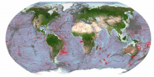
Mapping northern Greenland waters
An understanding of the interplay between glaciers and the ocean is needed to improve sea-level rise projections. Seafloor mapping is critical in this pursuit, particularly where the ice sheets of...
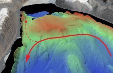
An understanding of the interplay between glaciers and the ocean is needed to improve sea-level rise projections. Seafloor mapping is critical in this pursuit, particularly where the ice sheets of...
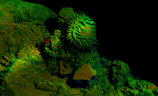
Voyis, a pioneer in optical solutions for subsea vehicles, has announced its work with Memorial University of Newfoundland on an extraordinary scientific expedition to the Galápagos Islands, funded by Schmidt...

Fugro recently introduced its next-generation coastal mapping system, the Rapid Airborne Multibeam Mapping System (RAMMS 2.0), at the Hydro 2023 conference in Genoa, Italy. RAMMS 2.0, the world’s only airborne...
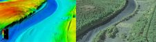
The US Geological Survey (USGS) and Dewberry have jointly released a new topobathymetric Lidar dataset for the Potomac River, extending from the Potomac Highlands in West Virginia to the Chesapeake...
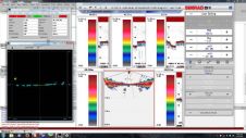
Five NOAA fishery survey vessels have been equipped with the HYPACK and HYSWEEP software solution. The vessels, outfitted with the Simrad ME70 scientific multibeam system on board, is used by...
Proteus FZC, UAE, has launched a fast-turnaround habitat mapping solution designed for Environmental Impact Assessments (EIAs). Through the service, Proteus delivers high-resolution classification maps of terrestrial areas onshore and on...

After a long break due to the COVID-19 pandemic, Kongsberg recently organized its 17th Forum for the Exchange of Mutual Multibeam Experiences (FEMME) in Edinburgh, UK. The FEMME conference brought...
FarSounder is partnering with The Nippon Foundation-GEBCO Seabed 2030 Project to work together to advance the collective understanding of the ocean floor in pursuit of the complete map of the...
JNCC has launched the new MESH website. The site has been enlarged and completely redesigned to reflect the enormous number and range of products that the project has generated over...
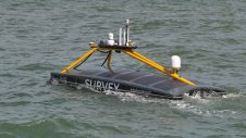
Marine data provider XOCEAN recently deployed five uncrewed surface vessels (USVs) near the Isles of Scilly to collect bathymetric data on behalf of the UK Hydrographic Office (UKHO). The USVs...
This site uses cookies. By continuing to use this website, you agree to our Cookies Policy. Agree