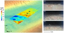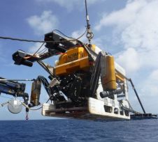
Global Oceans Acquires 6000m ROVs and Towed Sonar System from Oceaneering
Global Oceans, a New York-based non-profit corporation focused on mobilizing commercial sector resources for ocean science has acquired, through a donation from Oceaneering International, three deep-sea exploration vehicles rated to...