S-44 and the systematic error
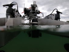
IHO standard S-44 is often used (or misused) to specify the quality of a hydrographic survey. While it is a useful tool, it is easy to misinterpret. One ‘misuse’ is...

IHO standard S-44 is often used (or misused) to specify the quality of a hydrographic survey. While it is a useful tool, it is easy to misinterpret. One ‘misuse’ is...
HydroSurv, a prominent provider of electric and hybrid uncrewed surface vessels (USVs), has successfully secured Innovate UK funding to advance the commercialization of an end-to-end seagrass monitoring solution. This endeavour...
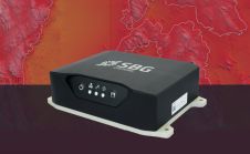
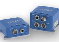
SBG Systems has released the Horizon IMU, a FOG-based high-performance inertial measurement unit (IMU) designed for large hydrographic vessels surveying harsh environments. Navsight Marine Solution consists in a powerful and...
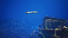
The Mexico port authorities have enhanced their port security capabilities with the recent acquisition of nine advanced Oceanbotics SRV-8 professional underwater drones (ROVs). This strategic move aims to elevate their surveillance...
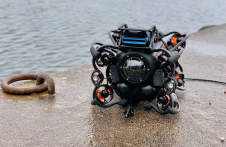
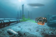
Assets on the seabed, such as offshore wind turbines, natural resource extraction systems and underwater cables, serve as critical subsea infrastructure. To efficiently build, monitor, protect and maintain these assets,...
SBG Systems has taken a major step in the surveying industry by unveiling Qinertia, its in-house post-processing software, at the Ocean Business show (UK). After the survey, this full-feature software...
SBG Systems has appointed Swathe Services to be an authorised sales and support distributor for the marine hydrography market in the UK and Ireland. This includes all products within the...
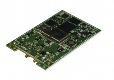
SBG Systems has selected the Septentrio AsteRx4 OEM GNSS receiver to equip the Apogee product line. The Apogee is a new product line of highly accurate inertial navigation systems based...
The esteemed Finnish Geospatial Research Institute (FGI) is set to utilize advanced Lidar systems developed by the Fraunhofer Institute for Physical Measurement Techniques IPM for future maritime surface surveys. Anticipating...
Lidar, short for Light Detection and Ranging surveying, represents a sophisticated measuring system leveraging the power of light. Widely recognized for its versatility, Lidar is extensively applied in diverse fields...
This site uses cookies. By continuing to use this website, you agree to our Cookies Policy. Agree