Research-driven Tools for Ocean Mappers
Current technologies can help ocean mappers and cartographers to fight repetitive, manual and error-prone routines the smart way. In a world where artificial intelligence is playing a key role in...
Current technologies can help ocean mappers and cartographers to fight repetitive, manual and error-prone routines the smart way. In a world where artificial intelligence is playing a key role in...
Teledyne CARIS has released Bathy DataBASE (BDB) 4.4. This new version addresses the areas of feature generalisation and automation of product generation for chart compilation, as well as the increasing...
Ahead of the IHO’s compliance deadline of 31 August 2017, the United Kingdom Hydrographic Office (UKHO) urged owners and operators to ensure their ECDIS systems are using S-52 Presentation Library...
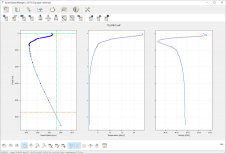
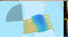
One feature of SonarWiz 7 is the Seabed Characterisation tool. It incorporates bathymetric slope, roughness, TPI and any spatially distributed variable that can aid the characterisation algorithm to generate classes...
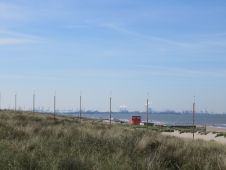
To fulfill its mission to “continually improve the Port of Rotterdam and to make it the safest, most efficient and most sustainable port in the world“, Rijkswaterstaat, part of the...
The International Board on Standards and Competence for Hydrographic Surveyors and Nautical Cartographers (IBSC) recognised and approved Coast Survey’s certification programme in cartography (CAT-B) at its 40th meeting in Wellington,...
With HIPS and SIPS and the Bathy DataBASE (BDB) suites of products being closely aligned, the BDB 4.3 release follows hot on the heels of HIPS and SIPS 10.2. These...
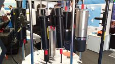
EvoLogics GmbH is showcasing the company’s recent developments at the Ocean Business 2017 exhibition in Southampton, UK, including new products, developer solutions and successful R&D efforts. The latest and biggest...
Seaports, waterways and climate are inextricably linked. Weather anomalies change bottom contours and destroy aids to navigation, compromising safety. In the past decade, maritime applications, maturing marine technologies and crowdsourcing...
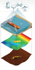
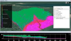
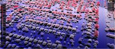
Charting underwater structures, soils and project progression using GPS, sonar, single and multibeam systems produces a huge amount of data that needs to be analysed. Vast project areas can be...
This site uses cookies. By continuing to use this website, you agree to our Cookies Policy. Agree