‘As it Was’
In the summer of 1943, when planning the landing in Normandy, it was found that the best available charts showing offshore depths were based on surveys dated 1875. It was...
In the summer of 1943, when planning the landing in Normandy, it was found that the best available charts showing offshore depths were based on surveys dated 1875. It was...
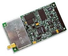
The DG14 RTK offers high-precision in a low-cost GNSS unit. The DG14 RTK from Magellan is a sub-meter GNSS (GPS + SBAS) and Beacon receiver. DG14 RTK was developed to...
MAX, the new dynamic chart technology from C-Map is now available, enhancing the new generation chartplotter functionality of Simrad's recently launched CX NavStation Series. As the third generation of C-Map...
CSI Wireless Inc. was established in 1990 on the Canadian prairies to develop and supply GPS navigation and mapping systems to oil exploration and production crews in the Gulf of...
Google Earth has become a popular 3D web-mapping viewer, mainly due to the richness of satellite imagery in its primary database. However, the database contains very limited marine data. While...
The coastal zone of Nigeria has in recent years been subjected to increasing economic activities, primarily driven by seaport activities and oil exploration and exploitation. These activities have reportedly resulted...
The River Murray Operations Unit (RMOU) of the South Australian Water Corporation surveys very shallow waters, a type of surveying that has its own specific problems overcome by non-conventional solutions....
While Google Earth is the best known 3D web-mapping viewer currently in the public domain, there are alternative virtual globe viewers available. In particular, this article focuses on the NASA...
While Google Earth is the best known 3D web-mapping viewer currently in the public domain, there are alternative virtual globe viewers available. In particular, this article focuses on the NASA...
Merrick & Company has been awarded the Precision Topographic and Bathymetric Mapping project for the Yellowstone River Conservation District Council. Merrick will provide GPS and bathymetric surveys, LIDAR data acquisition,...
This site uses cookies. By continuing to use this website, you agree to our Cookies Policy. Agree