Found 168 results
Sort by

Australia Tests Improved National Positioning

According to Geoscience Australia, technology companies GMV, Inmarsat and Lockheed Martin have joined Australia's two-year national positioning project. The project is trialling a Satellite Based Augmentation System (SBAS) to improve...

Read more

5 Questions to Nicolas Seube

Nicolas Seube is scientific director of the CIDCO (Interdisciplinary Center for the Development of Ocean Mapping), Rimouski, Québec, Canada; formerly the coordinator of the French Category A programme at ENSTA...

Read more

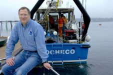
5 Questions to Larry Mayer

Larry Mayer is professor and director of the School of Marine Science and Ocean Engineering and director of the Center for Coastal and Ocean Mapping, University of New Hampshire, USA....

Read more

Training and GNSS Handbook

During the Oceanology International event in the UK, Skilltrade and N-Sea welcomed professionals and students at morning survey training sessions. Skilltrade also received several questions about certification and competence, as...

Read more

Study the Basics and Ask for Support

Hydrographic mapping is all about collecting and processing data that leads  to products such as nautical charts and other products contributing to safe navigation, a better environment and secure constructions...

Read more