Hydrography 2.0
This month's theme is hydrography and living resources. However, you won't find any articles on the subject in this magazine. A bit strange coming from me, who for years worked...
This month's theme is hydrography and living resources. However, you won't find any articles on the subject in this magazine. A bit strange coming from me, who for years worked...
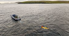
The National Oceanography Centre (NOC), working with the University of Southampton and the Department for Environment, Food and Rural Affairs (Defra), recently completed a Fully Autonomous Marine Protected Area Seafloor...

The development of unmanned and autonomous surface vehicles in recent years has triggered a new era in civilian and military maritime operations. One of the applications that is likely to...
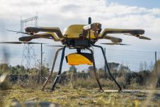
YellowScan, a familiar name in the mapping and land surveying realm, is making a noteworthy entrance in the hydrographic sector with the introduction of its pioneering UAV-based bathymetric Lidar solution....
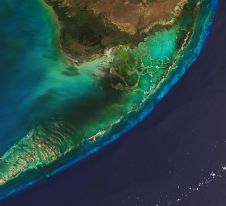
The Florida Department of Environmental Protection has commissioned Woolpert to acquire bathymetric survey data using Lidar technologies to support the Florida Seafloor Mapping Initiative (FSMI) and its mission to produce...
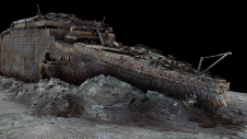
Magellan, a deep-sea mapping company, and Atlantic Productions, a British television company, have embarked on an ambitious collaboration to conduct a comprehensive scan of the RMS Titanic. This iconic British...
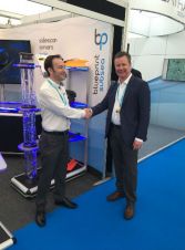
SUBSEA 20/20, USA, was recently named an authorised sales agency for Blueprint Subsea, a UK hydroacoustic instrument manufacturer. An agreement of representation was formalised at the recent Ocean Business conference...
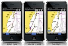
Navionics will be hitting the water with the newest version of our Mobile App created specifically for iPhone users. The charts are available for an expert mariner already familiar with...
This site uses cookies. By continuing to use this website, you agree to our Cookies Policy. Agree