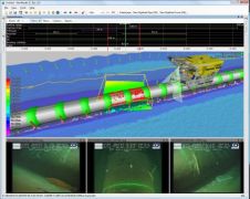
Automated Monitoring System
BioSonics is to unveil its latest generation of Automated Monitoring Systems at the OCEANS 2010 conference next month. This sonar-based tracking and monitoring system centres around BioSonics focused split-beam hydro-acoustic...