E-map Project for Powertech
A B$9.5 million project for the delivery of Brunei's national Spatial Data Infrastructure (NSDI) was officially contracted end of April 2007 during a signing ceremony between the Ministry of Development...
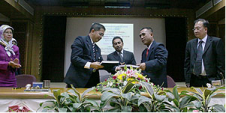
A B$9.5 million project for the delivery of Brunei's national Spatial Data Infrastructure (NSDI) was officially contracted end of April 2007 during a signing ceremony between the Ministry of Development...
A growing problem exists with forward-deployed electronic chart display and information systems (ECDIS) in obtaining and updating geospatial data(electronic nautical charts). This problem is commonly referred to as distributing geospatial...
The availability of various sensors and sophisticated technology providing digital data means that today’s hydrographers must attune to the idea that the final products should be available in a hydrographic...
An international team of scientists, working over the last four years, has developed a framework for Mapping European Seabed Habitats (MESH). The project achievements far exceeded those originally planned, and...
Global warming, climate change, rising sea levels and increased commercial exploitation of the seabed and sea space are important global indicators of a changing world environment. A crucial role is...
JNCC has launched the new MESH website. The site has been enlarged and completely redesigned to reflect the enormous number and range of products that the project has generated over...
A great deal of metadata is registered during hydrographic survey. This data (information on survey conditions, online and offline filter settings and calibrations) is essential for assessment of the quality...
The Military Survey Department of the Armed Forces is the sole federal mapping agency and entity in the United Arab Emirates (UAE). It is responsible for co-ordinating, processing and disseminating...
News East Australia Region The East Australia Region of the Australasian Hydrographic Society held a General Meeting, hosted by David Garforth and his Bruttour International team, at ‘The Ranch’, Eastwood,...
Until recently, each survey organisation or hydrographic service had its own system for numbering surveys and the fair sheets, bottom samples and other records that comprised a survey project. An...
This site uses cookies. By continuing to use this website, you agree to our Cookies Policy. Agree