Mapping water column content during bathymetry surveys
Measuring suspended particulate matter in the water column is still a big challenge when it comes to covering large areas in the sea or rivers. A novel method to monitor particles...
Measuring suspended particulate matter in the water column is still a big challenge when it comes to covering large areas in the sea or rivers. A novel method to monitor particles...
Aurigo Software, a leading provider of capital planning and construction management software for infrastructure and private owners, is partnering with the University of Florida’s Department of Mechanical and Aerospace Engineering...
HydroSurv has won funding from Innovate UK to continue working with the University of Plymouth to enhance its technique of using uncrewed surface vessels (USVs) to map seagrass coverage on...
Geosciences survey companies face a constant challenge in securing and moving data. Operating in far-flung, barely connected parts of the world, with temperatures and weather hard to predict, they deploy scanning and...

Renewable energy and the pivotal role of hydrography in offshore development take centre stage in a captivating interview with Professor Ed Hill, chief executive of the National Oceanography Centre (NOC)....
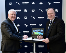
The global effort inspiring the complete mapping of the world’s ocean floor – The Nippon Foundation-GEBCO Seabed 2030 Project – has announced its newest partnership with Norbit Oceans, a leading...

A mobile application for Marine and Hydrographic contractors across the iPhone, Android and BlackBerry Playbook platforms has been launched by G.O.S.S. Consultants, UK. This recruitment application adds another level of...
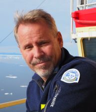
Larry Mayer is a professor and director of the Center for Coastal and Ocean Mapping at the University of New Hampshire. His research deals with sonar imaging and remote characterization...
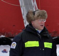
Martin Jakobsson is professor of Marine Geology and Geophysics at Stockholm University. His research interests include the marine cryosphere, with a current focus on northern Greenland, glacial landforms and seafloor...
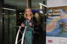
Seabed mapping will play a crucial role in protecting the UK’s climate, oceans and coastal communities, as highlighted by Sally-Ann Hart, Member of Parliament (MP). Speaking at the recent UK...
This site uses cookies. By continuing to use this website, you agree to our Cookies Policy. Agree