Hydrus
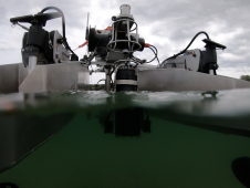
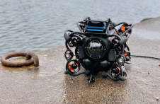
Hydrus is a micro-autonomous underwater vehicle that makes marine surveying easy and affordable. Hydrus takes the drone revolution underwater with the most advanced navigation and communication systems of any subsea...
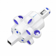
Hydrus is a micro-autonomous underwater vehicle that makes marine surveying easy and affordable. Hydrus takes the drone revolution underwater with the most advanced navigation and communication systems of any subsea...
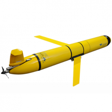
The Slocum glider is buoyancy-driven to enable long-range and duration remote water column observation for academic, military, and commercial applications. It can be deployed and recovered from any size vessel with minimal time on station The Slocum glider is buoyancy driven to enable long range and duration remote water column observation for academic, military, and commercial applications. The Slocum Glider can be deployed and recovered...
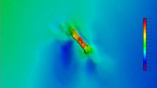
A 120-year-old mystery has been solved with the help of a CSIRO team aboard the RV Investigator. Heritage NSW has announced the discovery of the SS Nemesis, a 73-metre iron-hulled...
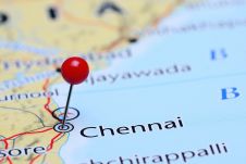
IIT Madras has established a Centre of Excellence (CoE) dedicated to advancing indigenous maritime technology and expertise. The team of researchers leading this initiative has been actively engaged in notable...

IHO standard S-44 is often used (or misused) to specify the quality of a hydrographic survey. While it is a useful tool, it is easy to misinterpret. One ‘misuse’ is...
HydroSurv, a prominent provider of electric and hybrid uncrewed surface vessels (USVs), has successfully secured Innovate UK funding to advance the commercialization of an end-to-end seagrass monitoring solution. This endeavour...

The Danish Geodata Agency, alongside several collaborators, is currently conducting trials on the latest iteration of navigational charts in the Baltic Sea region. This initiative forms part of an EU-funded...
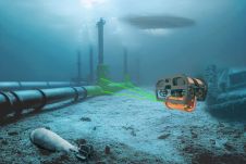
The Mexico port authorities have enhanced their port security capabilities with the recent acquisition of nine advanced Oceanbotics SRV-8 professional underwater drones (ROVs). This strategic move aims to elevate their surveillance...
The esteemed Finnish Geospatial Research Institute (FGI) is set to utilize advanced Lidar systems developed by the Fraunhofer Institute for Physical Measurement Techniques IPM for future maritime surface surveys. Anticipating...
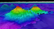
The crew of Schmidt Ocean Institute’s research vessel Falkor (too) recently discovered four underwater mountains – the tallest of which exceeds 2.4km in height – during a January transit from...
This site uses cookies. By continuing to use this website, you agree to our Cookies Policy. Agree