Surveying beyond navigation
Hydro International interviewed RDML Benjamin Evans, director of NOAA’s Office of Coast Survey. Evans is responsible for overseeing the mapping and charting of all US coastal waters, as well as...
Hydro International interviewed RDML Benjamin Evans, director of NOAA’s Office of Coast Survey. Evans is responsible for overseeing the mapping and charting of all US coastal waters, as well as...
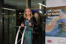
Seabed mapping will play a crucial role in protecting the UK’s climate, oceans and coastal communities, as highlighted by Sally-Ann Hart, Member of Parliament (MP). Speaking at the recent UK...
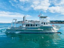
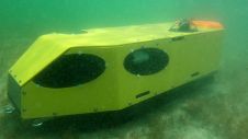
All American Marine (AAM), together with Geodynamics, an NV5 company, has announced the delivery of an advanced research and hydrographic survey vessel intended for servicing the growing offshore wind market...
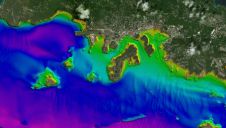
In many places around the world, data clearly shows a rise in sea level. In low-lying coastal areas, even small increases when coupled with high tides and storm surges can...
In July 2022, an environmental disaster hit the Oder River, a vital waterway for both Poland and Germany. The mass die-off of fish triggered an extensive investigation into the possible causes, but could this tragedy have been prevented? In July 2022, an environmental disaster hit the Oder River, a vital waterway for both Poland and Germany. The mass die-off of fish triggered an extensive investigation into the possible...
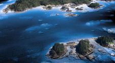
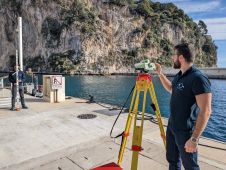
The National Oceanic and Atmospheric Administration (NOAA) contracted NV5 Geospatial to define the shoreline in an extremely complex area of south-east Alaska as part of the NGS Coastal Mapping Program....
Measuring suspended particulate matter in the water column is still a big challenge when it comes to covering large areas in the sea or rivers. A novel method to monitor particles...
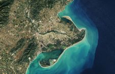
Scientists from the National Oceanography Centre (NOC) have discovered a substantial rise in sea levels in the Mediterranean Sea, using a vital new method to measure changes in sea level....
Since the 1970s, remote sensing has increasingly been used to conduct underwater surveys. Several methodologies are employed in hydrographic surveying, from direct techniques such as probing rods to more sophisticated...
Unique Group has successfully supported the Australian Institute of Marine Science in completing a carbon-conscious bathymetric survey at Cape Ferguson by performing seabed modelling for their upcoming project, using its...
This site uses cookies. By continuing to use this website, you agree to our Cookies Policy. Agree