Spatial Planning Support for Marine Park
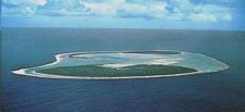
At the Eye on Earth Summit in Abu Dhabi last week, the Geographic Information System (GIS) software company Esri committed to building a database for the Cook Islands Marine Park...
At the Eye on Earth Summit in Abu Dhabi last week, the Geographic Information System (GIS) software company Esri committed to building a database for the Cook Islands Marine Park...

Marine Spatial Data – all information about the marine environment that has a positional attribute – has been the business of everyone involved with hydrography since the first survey was...

C&C Technologies is currently offering the public a free Gulf of Mexico (GoM) Geographic Information System (GIS) planning tool. "CCGIS Map" provides users with on-line graphic visualisation coordinates of the...

Digipilot is an official Digital Nautical Publication, developed and issued by the Hydrographer of the Royal Netherlands Navy and provides the mariner with the necessary information to plan his voyage...
While the advantages of Geographic Information Systems (GIS) for storing and displaying spatial data are widely recognised, the analytic capabilities are less well known outside the GIS community. Extensions to...
The Alfred Wegener Institute for Polar and Marine Research (AWI) and Werum Software & Systems have signed an agreement today on the technology transfer of a software program for planning...
The position of bathymetric sensors in hydrographic education is beyond discussion, as bathymetry is, was and will continue to be the bread and butter of the hydrographic surveyor. Bathymetric sensors...
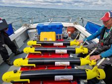
In a pioneering project funded by Innovate UK, the development of a fleet of marine robots known as Squads of Adaptive Robots (SoAR) promises to reshape the landscape of ocean...

In an era of environmental challenges and economic uncertainties, nations are earnestly seeking innovative ways to stimulate economic development, improve public safety and enhance the quality of life for their...
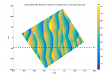
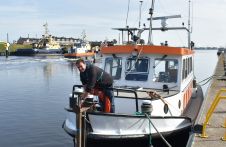
Optimizing the national hydrographic survey planning and monitoring scheme of the Netherlands Continental Shelf (NCS) towards an efficient and sustainable outcome requires a more comprehensive evidence-based approach to decision-making. The...
This site uses cookies. By continuing to use this website, you agree to our Cookies Policy. Agree