SurvTech Selects NEXUS 800 for Aerial Mapping
A NEXUS 800 UAS powered by HYPACK has been provided to the US southeastern geospatial solutions company SurvTech. The company will use the device to acquire upland data simultaneous with subaqueous data and make a seamless point cloud of upland and submerged data. The integration with the company’s heading RTK GPS, IMU, sonar and HYPACK was experienced as straightforward.
President David O’Brien of SurvTech stated they have been collecting mobile LiDAR with the HYPACK solution from their boats and trucks and are extremely happy with the datasets.
Choice of the NEXUS 800 UAS
When planning to equip a UAV copter with the Puck sensor, heading RTK GPS, IMU and computer processing board, SurvTech aimed for a commercial grade copter that would be extremely robust and have built in redundancy. When estimating the cost of purchasing the components, including an onboard computer and software that would integrate the LiDAR and position data, the NEXUS appeared to be the right solution, based on the company’s familiarity with system, quality, price and HYPACK’s technical support.
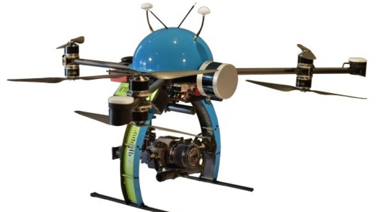
The NEXUS 800 Characteristics
The NEXUS 800 powered by HYPACK is an end-to-end solution representing a new paradigm in Unmanned Aerial System (UAS) data collection by harmonising Lidar data with photogrammetry. The NEXUS 800 is a turnkey system that integrates hardware and software from HYPACK, Infinite Jib, SBG Systems and Velodyne to provide a solution for LiDAR survey planning, data acquisition, post processing and analysis and product creation.
Powered by HYPACK-HYSWEEP mapping software, the operator can plan, acquire, and process the Lidar and photogrammetry data onboard a high powered Windows PC and high performance UAS allowing for rapid analysis and product creation of a variety of CAD and GIS formats.


