Charting Aspects of the Volvo Ocean Race Stranding
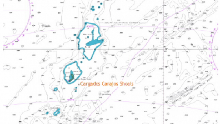
During Leg 2 of the Volvo Ocean Race from Cape Town to Abu Dhabi, Team Vestas Wind ran aground on the night of 29 November 2014 on the Cargados Carajos Shoals. The shoals were shown on the portion of the electronic chart displayed onboard, but only as a blue patch enclosed by a 200m isobath with scattered soundings – the shoalest of which the navigator reported to be 40m. This article presents the facts and views of various experts including their impressions in the immediate aftermath of the stranding.
The fact that the feature comprised low-lying islands with a fringing drying reef is only apparent when zooming in sufficiently on the Electronic Chart System (ECS). What are the factors that played a role from charting and marine mapping perspective? What can be done to avoid this kind of accident – even taking into account the special circumstances that a race brings?


