Advanced Navigation, known for its expertise in AI robotics and navigation technology, is making strides in ocean exploration with its underwater drone, Hydrus. This innovative device recently explore...

Researchers have discovered the deepest sinkhole known on Earth, located underwater near the border of Mexico and Belize. Previously believed to be the second-deepest of its kind, the Taam Ja' Blue Ho...

Rutgers University and Teledyne Webb Research unveiled The Sentinel Mission in a remarkable display of academic and technological collaboration. This unprecedented initiative marks the beginning of an...

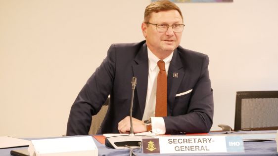
At the invitation of the Bahamian Ministry of Foreign Affairs, IHO Director Luigi Sinapi conducted a high-level visit to the Commonwealth of The Bahamas from 15-19 April. The visit aimed to resume dis...

Oceaneering International has shared that its Subsea Robotics segment recently completed a successful one-week Autonomous Underwater Vehicle (AUV) demonstration for the U.S. Navy and Defense Innovatio...
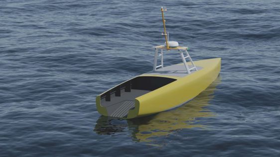
Zero USV confirms it is well under way with the build of its first two vessels following a highly successful edition of Oceanology International, where it announced its partnership with marine techno...
Admittedly, the title of this column, formulated as a question, is deliberately provocative. The first reaction of those who read it and are interested in hydrography for professional reasons will pro...

By harnessing capabilities of advanced satellite technology and ever-evolving data analysis, satellite-based mapping (including satellite-derived bathymetry, SDB) offers an efficient, extensible and c...
In an era of great power competition, unmanned maritime systems (UMSs) have begun to take centre stage and are now on an accelerated development path for reasons that are clear. Like their air and gro...
In the quest to unravel the mysteries beneath our planet’s water bodies, topobathymetric technologies emerge as a beacon of innovation. Among them, Lidar (light detection and ranging) and sonar sens...
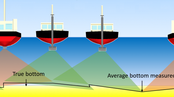
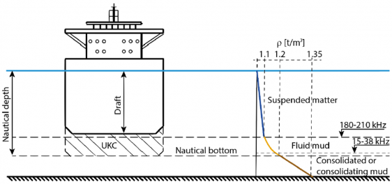
IHO standard S-44 is often used (or misused) to specify the quality of a hydrographic survey. While it is a useful tool, it is easy to misinterpret. One ‘misuse’ is to apply the IHO orders directl...
In a March 2023 blog, Microsoft founder, billionaire entrepreneur and philanthropist Bill Gates said: “The development of AI is as fundamental as the creation of the microprocessor, the personal com...
By submitting this form, you agree to our Terms of Service and Privacy Policy .


We encourage you to subscribe to our weekly newsletter. Subscribers also receive a digital copy of our bi-monthly magazine.
This site uses cookies. By continuing to use this website, you agree to our Cookies Policy. Agree