How ocean drones can help enable renewable energy
Accelerating access to renewable energy sources is a critical element of mitigating the crisis of climate change. Like their on-land counterparts, offshore wind farms provide clean, renewable energy. However, offshore wind speeds tend to be higher and more consistent than over land, exponentially increasing the amount of power generated. Saildrone is the only uncrewed wind-powered vehicle to support the entire life cycle of an offshore wind farm.
Saildrone unveiled its offshore wind life cycle solutions at IPF, the premier offshore wind conference held in Richmond, VA in the U.S. in August 2021. Showcasing the seven-metre Saildrone Explorer at the event, Saildrone demonstrated how its uncrewed surface vehicles (USVs) – carrying state-of-the-art scientific sensors – enable the offshore wind industry to get the ocean data it needs to establish and maintain a wind farm faster and at a fraction of the cost of traditional methods.
The broad range of data required for offshore wind farm sites
Offshore wind farms require a large amount and variety of data throughout their life cycles. Once a site is identified for wind farm development, extensive data must be collected about the movement of water (levels and flows, sea states, waves), wind conditions and other atmospheric and oceanographic metrics. The data is to support efficient design, installation and long-term maintenance, as well as establish an ecological baseline to monitor potential impact.
The Marine Mammal Commission supports the establishment of offshore renewable energy, but calls for any new proposed project to proceed in a “thoughtful and deliberate manner”. To protect marine mammals in the area, migration patterns must be tracked and underwater sound levels monitored during construction. Wind farm developers also require a detailed understanding of the ocean floor and continuous surveying for topographical shifts due to sediment redistribution by ocean currents. Once a site is operational, continuous monitoring is required to address vandalism and sabotage.
Multiple approaches to survey tasks
All of the above tasks are typically carried out by fixed moorings, met towers or humans working on survey vessels. This significantly raises the cost and labour-intensity of establishing and maintaining an offshore wind farm. Permits are required to deploy moorings and met towers (and ships are needed to deploy them), survey vessel time is expensive and difficult to schedule, and inclement weather can make it dangerous, not to mention uncomfortable for human crews.
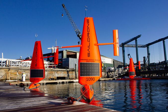
Saildrone’s three classes of autonomous vehicles work together to collect the data throughout the life cycle of the wind farm. Each vehicle is designed for specific tasks and can be deployed from any dock, no permits required. Their innovative design efficiently delivers the critical data needed, from comprehensive real-time metocean data including wind monitoring, to high-resolution ocean mapping, persistent year-round ecosystem monitoring and maritime security solutions.
Saildrone autonomous vehicles
The Saildrone Explorer delivers persistent year-round monitoring of a comprehensive set of metocean data. It can remain on mission for up to 12 months with a zero-carbon operational footprint, transmitting critical data back to Mission Control in real time and sailing autonomously back to base for recalibrations and service.
The Saildrone Voyager, currently in development, is a 10-metre USV equipped with a complete set of metocean sensors and a continuous wave Lidar, which measures wind speed and direction across the turbine height. The Voyager is also optimized for wind farm security, providing persistent advanced situational awareness. Saildrone’s passive acoustics, optical cameras and advanced machine learning algorithms deliver real-time detection of anything in the vicinity of offshore wind farms, including commercial and recreational boats or other vessels that may choose not to transmit their position, as well identifying natural visitors such as whales, seabirds and bats to support environmental impact mitigation strategies.
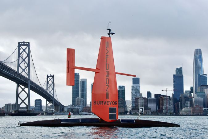
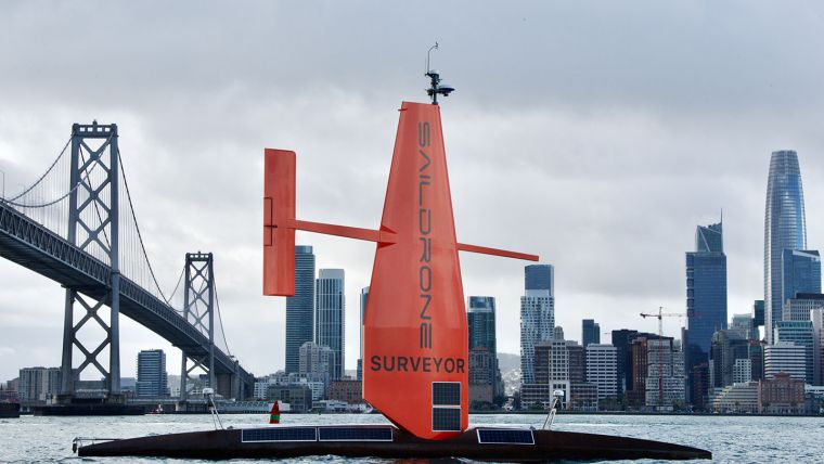
The Saildrone Surveyor is a 22-metre USV providing IHO-compliant multibeam ocean mapping that exceeds the quality delivered by traditional methods. The Surveyor can map continuously for over 180 days, delivering hydrographic information faster, at a higher quality and at a fraction of the cost of survey ships.
Missions for science, ocean mapping and maritime security
The capabilities of Saildrone’s autonomous vehicles have been proven in numerous operational missions for science, ocean mapping and maritime security, covering over 500,000 nautical miles from the Arctic to the Antarctic. The Saildrone fleet has logged more than 13,000 days at sea in some of the most extreme weather conditions on the planet.
The data collected by Saildrone vehicles 24/7/365 will advance understanding of wind and wildlife patterns across an entire lease area, informing the most environmentally responsible and efficient design, project layout and turbine siting. And, Saildrone USVs are predominantly wind-powered, significantly reducing the carbon footprint of establishing a renewable energy source.
Learn more about Saildrone’s offshore wind solutions.
Resources
Marine Mammal Commission, Renewable Energy Development and Marine Mammals, mmc.gov, accessed 24 August 2021