Neotek Launches SEA360 Underwater Data Service
Neotek, a French subsidiary of the Sea Vorian group and a specialist in navigation and robotics instruments and the design of marine data measurement systems, has launched an innovative underwater...
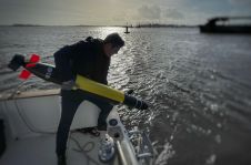
Neotek, a French subsidiary of the Sea Vorian group and a specialist in navigation and robotics instruments and the design of marine data measurement systems, has launched an innovative underwater...
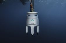
Grandeur Subserv, a company specializing in underwater and environmental engineering services, recently acquired an Exail Gaps M5 USBL system for shallow water geophysical surveys on the Nigerian coast. In search...
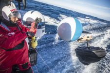
The forthcoming edition of The Ocean Race, which sets sail from Alicante, Spain, on 15 January, is set to feature the most ambitious and comprehensive science programme created by a...
SBG Systems is a leading supplier of compact, high-performance & cost-effective inertial motion sensing solutions. Our Motion Sensors and Inertial Navigation Systems are ideal for hydrographic applications, ship motion monitoring,...
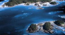
The National Oceanic and Atmospheric Administration (NOAA) contracted NV5 Geospatial to define the shoreline in an extremely complex area of south-east Alaska as part of the NGS Coastal Mapping Program....
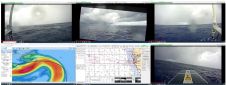
SeaTrac Systems, in collaboration with the Woods Hole Group (WHG), has successfully completed a 21-day over-the-horizon deployment of SeaTrac’s SP-48 solar powered uncrewed surface vehicle (USV) in the Gulf of...
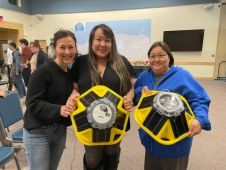
A new ocean science effort to improve equity and inclusion is underway, thanks to a US$4.98 million cooperative agreement with three regional associations of the NOAA-led U.S. Integrated Ocean Observing...
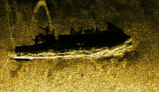
The mysterious Black Sea has many secrets yet to be discovered. This research presents the results of the biggest UXO survey project performed on the Romanian Black Sea coast after...

Saildrone has been selected to receive a major award from the National Offshore Wind Research and Development Consortium (NOWRDC) to facilitate offshore wind’s coexistence with wildlife and other ocean users....
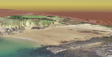
To understand coastal change and anticipate what our future coast will look like, scientists carry out regular field surveys in the form of beach profiles and digital elevation models (DEMs)....
This site uses cookies. By continuing to use this website, you agree to our Cookies Policy. Agree