Mapping Underwater Habitat
Biosonics’ Visual Habitat DT-X is a software product for the rapid assessment and mapping of aquatic habitat features. With Visual Habitat software, users can present information in a clear and...
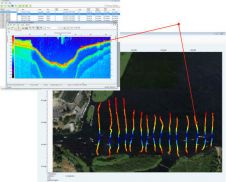
Biosonics’ Visual Habitat DT-X is a software product for the rapid assessment and mapping of aquatic habitat features. With Visual Habitat software, users can present information in a clear and...
The establishment of multi-beam echo sounders (MBES) as a mainstream tool in ocean mapping has revolutionised approaches towards nautical charting, seafloor geotechnical/geological surveys and benthic habitat mapping. The resolution of...
Two decades ago as CO of a survey ship, I interpreted the SSS-registrations (still on wet paper) twice. Once was for nautical charting purposes and the second, in my own...

In the quest to unravel the mysteries beneath our planet’s water bodies, topobathymetric technologies emerge as a beacon of innovation. Among them, Lidar (light detection and ranging) and sonar sensors...
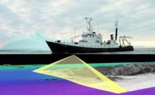
Autonomous vessel experts and artificial intelligence (AI) pioneers behind the first full-size unmanned research vessel to conduct scientific experiments while autonomously navigating the Atlantic Ocean have announced their plans to...

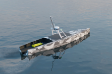
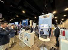
Oceanology International 2024 (Oi24) is set to captivate attendees with a showcase of pioneering companies and innovative technologies, all poised to command attention at London's ExCeL. From advanced autonomous vehicles...
In a roundup of the hydrographic industry’s latest developments in multibeam echosounding technology, this issue dives into the depths of hydrographic survey data, uncovering advanced techniques and tools that are...
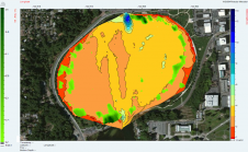
BioSonics, USA, has released Visual Habitat 2.0 (VH2), specialised software for the assessment and mapping of aquatic habitat features including seagrass, bathymetry, and various substrate types. This upgraded version includes...
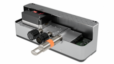
EM 2042 Multibeam Echosounder Small in size, but powerful in potential, the EM 2042 Multibeam Echosounder is efficient, light, robust and reliable: delivering high-density, high-resolution, clean data in the most demanding marine environments. With...
RIEGL has announced the launch of two innovative topobathymetric scanners. These advancements mark a shift towards enhanced efficiency and precision in data collection across land and water interfaces. The RIEGL...
This site uses cookies. By continuing to use this website, you agree to our Cookies Policy. Agree