Jacek Łubczonek
Jacek Łubczonek conducts research on hydrographic and topographic data processing using geoinformatics techniques and artificial intelligence methods at the Maritime University of Szczecin, Poland. He received a PhD in geodesy...

Jacek Łubczonek conducts research on hydrographic and topographic data processing using geoinformatics techniques and artificial intelligence methods at the Maritime University of Szczecin, Poland. He received a PhD in geodesy...
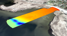
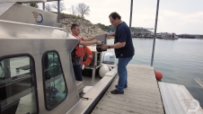
Uncrewed vehicles, both surface and airborne, are increasingly being used for hydrographic surveying. While the technology of data acquisition using these platforms is generally known, the fusion of this data...
Leica Geosystems, part of Hexagon, has announced the introduction of Leica Chiroptera-5, the new high-performance airborne bathymetric Lidar sensor for coastal and inland water surveys. This latest mapping technology increases...
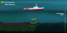
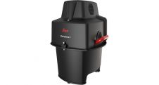
The Hi-Target HD-MAX dual-frequency echosounder is universal in sediment measurement for dredging and other water-depth measurement projects in shallow water, deep water and sandy water. The full-featured Hi-MAX Sounder hydrographic...
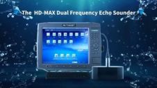
The Hi-Target HD-MAX dual-frequency echosounder is universal in sediment measurement for dredging and other water-depth measurement projects in shallow water, deep water and sandy water. The full-featured Hi-MAX Sounder hydrographic...
Geosciences survey companies face a constant challenge in securing and moving data. Operating in far-flung, barely connected parts of the world, with temperatures and weather hard to predict, they deploy scanning and...
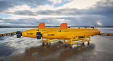
Imaging and geo-engineering specialist Argeo entered into an agreement for AUV work for Statens Vegvesen (Norwegian Public Roads Administration) on the Bjørnafjorden E36 crossing. The project, valued at 8.5 million NOK,...
Septentrio, a leader in high-precision GNSS positioning solutions, has launched two new GNSS products for marine applications: AsteRx-U3 Marine and AsteRx-m3 Fg. Both products offer accurate positioning near and offshore...
It is almost impossible these days to imagine geoinformation without GNSS, and most geodetic services have switched to GNSS to maintain their geodetic reference network rather than using traditional optical...
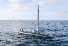
Ocean Aero, a manufacturer and service provider of ocean-going autonomous underwater and surface vehicles (AUSVs), has entered a partnership with King Abdullah University of Science and Technology (KAUST), one of...
This site uses cookies. By continuing to use this website, you agree to our Cookies Policy. Agree