Hydrographic surveying goes green
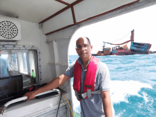
Amid new climate policies, the global energy transition is in full swing. This is leading companies and organizations to take a variety of measures to make their business operations more...
Amid new climate policies, the global energy transition is in full swing. This is leading companies and organizations to take a variety of measures to make their business operations more...
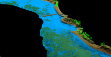
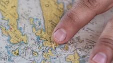
As part of a Catalan government project to improve the management of its marine environment, ICGC cooperated with Field to use airborne Lidar bathymetry (ALB) to survey the Catalan coastal...
Teledyne Geospatial will bring its latest advancements in ocean mapping hardware and software solutions to Ocean Business 2023, being held at the National Oceanography Centre, Southampton, UK from April 18-20....
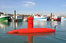
MIND Technology recently announced that the United States Patent and Trademark Office (USPTO) has granted a patent for its MA-X technology, which was designed and engineered by MIND’s Klein Marine Systems...
Which methods are being used to collect bathymetric data? How is that data converted into accurate bathymetric maps? And what else can it be used for? This issue zooms in on the latest developments in terms of both the hardware for capturing and generating accurate hydrographic data, and the software for processing it. This edition also takes a closer look at the wide variety of uses for hydrospatial data, including sometimes less-obvious applications. Which methods are being used to collect bathymetric data? How is that data converted into accurate bathymetric maps? And what else can it be used for? This issue zooms in...
Cartographers working in hydrographic offices and ENC editors have the responsibility of processing bathymetry datasets to generate ENCs compliant with the S-57 IHO standard. This is a time-consuming and fastidious task that requires a specific set of skills and knowledge. Nowadays, this expertise is challenged by the constant progress being made in data acquisition techniques and equipment, which has led to a significant increase in the number and size of bathymetry datasets. To face these challenges, the CARTONAUT project was launched by Shom cartographers in collaboration with GEOMOD marine geomatics engineers, both located in Brest, France. The project led to the creation of CALHYPSO, an automated solution for the generalization of bathymetry datasets for S-57 ENC production. This article reports the development of CALHYPSO through the CARTONAUT project and provides details about the tool’s concept and features. Cartographers working in hydrographic offices and ENC editors have the responsibility of processing bathymetry datasets to generate ENCs compliant with the S-57 IHO standard. This is a time-consuming and fastidious...
Much remains unknown about the benthic ecosystem that the blue economy depends on, and improved benthic habitat mapping is key to the sustainable development of the blue economy. While remote...
The Blue Economy Cooperative Research Centre (BE CRC) has entered into a new partnership with Echoview Software, the industry-leading hydroacoustic data processing science and software experts. Established in 2019, BE...
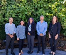
In this interview, Dr Gunathilaka, chair of FIG Commission 4 (2023–2026), discusses challenges and opportunities in the hydrographic industry. He emphasizes the need to attract and motivate young talent, reskill...
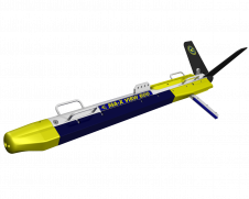
HydroSurv has won funding from Innovate UK to continue working with the University of Plymouth to enhance its technique of using uncrewed surface vessels (USVs) to map seagrass coverage on...
This site uses cookies. By continuing to use this website, you agree to our Cookies Policy. Agree