Canadian Seabed Research Ltd
The global effort inspiring the complete mapping of the world’s ocean floor – The Nippon Foundation-GEBCO Seabed 2030 Project – has announced its newest partnership with Norbit Oceans, a leading...

ASV’s C-Worker 6 successfully carried out a seabed transponder calibration in 1,300m-deep waters. The sea trials, which took place in the Gulf of Mexico, were conducted in rough conditions with...

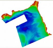
The Lithuanian Coastal Research and Planning Institute (CORPI) has recently completed the first ever 100% coverage survey of Klaipeda Harbour, Lithuania, using the Kongsberg GeoAcoustics GeoSwath Plus COMPACT system. This...
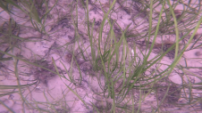
Seagrass meadows play an invaluable role as critical ecosystems that contribute significantly to marine biodiversity, carbon sequestration and coastal protection. In recent years, the importance of these underwater habitats has...
The Maritime and Coastguard Agency (MCA, UK) and six partner organisations launched the Ireland, Northern Ireland and Scotland Hydrographic Survey (INIS Hydro) project at the Belfast Harbour Commissioners Office on...
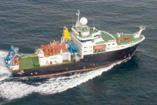
A voyage to find out what happens to seabed fauna in a deep-water trawling area if you leave it undisturbed several years got underway on 9th May 2011. The RRS...
Chesapeake Technology has added seabed classification to SonarWiz 5. The new functionality offers a fast and easy way to classify sea floor sediment, such as gravel and sand, for use...
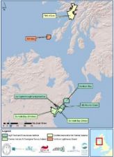
UK-based subsea services company Fathoms Ltd recently undertook two comprehensive surveys for the European Marine Renewable Energy Test Centre (EMEC) based in Orkney. The results of these surveys have enabled...
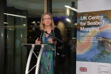
Seabed mapping will play a crucial role in protecting the UK’s climate, oceans and coastal communities, as highlighted by Sally-Ann Hart, Member of Parliament (MP). Speaking at the recent UK...
This site uses cookies. By continuing to use this website, you agree to our Cookies Policy. Agree