Geo-matching.com Adds Unmanned Aerial Systems
Geo-matching.com has announced the addition of a new category for Unmanned Aerial Systems. The types of Unmanned Aerial Systems (UAS) that qualify for inclusion in this new category are all...

Geo-matching.com has announced the addition of a new category for Unmanned Aerial Systems. The types of Unmanned Aerial Systems (UAS) that qualify for inclusion in this new category are all...
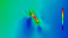
A 120-year-old mystery has been solved with the help of a CSIRO team aboard the RV Investigator. Heritage NSW has announced the discovery of the SS Nemesis, a 73-metre iron-hulled...

IIT Madras has established a Centre of Excellence (CoE) dedicated to advancing indigenous maritime technology and expertise. The team of researchers leading this initiative has been actively engaged in notable...
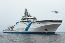
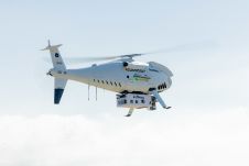
Schiebel’s Camcopter S-100 Vertical Takeoff and Landing (VTOL) Unmanned Air System (UAS) performed a five-day maritime surveillance demonstration aboard Offshore Patrol Vessel (OPV) Turva. The flight trials by the Border...

IHO standard S-44 is often used (or misused) to specify the quality of a hydrographic survey. While it is a useful tool, it is easy to misinterpret. One ‘misuse’ is...
HydroSurv, a prominent provider of electric and hybrid uncrewed surface vessels (USVs), has successfully secured Innovate UK funding to advance the commercialization of an end-to-end seagrass monitoring solution. This endeavour...
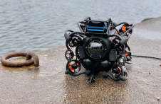
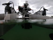
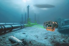
The Mexico port authorities have enhanced their port security capabilities with the recent acquisition of nine advanced Oceanbotics SRV-8 professional underwater drones (ROVs). This strategic move aims to elevate their surveillance...
Fugro recently introduced its next-generation coastal mapping system, the Rapid Airborne Multibeam Mapping System (RAMMS 2.0), at the Hydro 2023 conference in Genoa, Italy. RAMMS 2.0, the world’s only airborne...
The esteemed Finnish Geospatial Research Institute (FGI) is set to utilize advanced Lidar systems developed by the Fraunhofer Institute for Physical Measurement Techniques IPM for future maritime surface surveys. Anticipating...
Lidar, short for Light Detection and Ranging surveying, represents a sophisticated measuring system leveraging the power of light. Widely recognized for its versatility, Lidar is extensively applied in diverse fields...
This site uses cookies. By continuing to use this website, you agree to our Cookies Policy. Agree