Hydrographic Information Databases
The availability of various sensors and sophisticated technology providing digital data means that today’s hydrographers must attune to the idea that the final products should be available in a hydrographic...
The availability of various sensors and sophisticated technology providing digital data means that today’s hydrographers must attune to the idea that the final products should be available in a hydrographic...
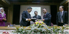
A B$9.5 million project for the delivery of Brunei's national Spatial Data Infrastructure (NSDI) was officially contracted end of April 2007 during a signing ceremony between the Ministry of Development...
The oceans are one of the last frontiers to be discovered. Covering three-quarters of the world, there have been discovered unique ecosystems, found mineral deposits and created charts for safer...
A breakthrough in signal conditioning has lead to significant improvements in single-beam and swath classification. With modern computers, this allows cost-effective bottom classification across multiple sonar platforms. The common dataset...
For several decades while coastal HF current-mapping radars were under development, they radiated rarely and only for a few weeks at a time. Now 120 commercial SeaSonde units have been...
The offshore Anchor Handling Tug Supply (AHTS) vessel Bourbon Orca, which recently won the 'Ship of the Year 2006' award, is just one of the vessels in the Bourbon Offshore...
The use of real-time flow information is increasing in the marine world. One example is the dredging industry which needs the information for dumping stones at great depths on a...
Google Earth and its related layer language Keyhole Markup Language (KML) have taken the mapping world by storm. Combining an approachable user interface, high-quality satellite imagery, and free cost (for...
When a hurricane, a tsunami, or other disaster occurs, one of the first and most critical challenges facing effective disaster response is rapid access to accurate spatial data. Safe Software...
Google Earth has become a popular 3D web-mapping viewer, mainly due to the richness of satellite imagery in its primary database. However, the database contains very limited marine data. While...
This site uses cookies. By continuing to use this website, you agree to our Cookies Policy. Agree