IVS 3D Wins 2006 Business Of The Year Award
IVS 3D was presented with the Information & Computer Technology (ICT) Global Business of the Year Award in Bedford (NH, USA). The award is given jointly by the Software Association...
IVS 3D was presented with the Information & Computer Technology (ICT) Global Business of the Year Award in Bedford (NH, USA). The award is given jointly by the Software Association...
Tenix LADS Corporation has commenced work on a hydrographic survey in the Torres Strait and northern Great Barrier Reef to help stop illegal fishing in Australian waters. Tenix, using its...
Land Information New Zealand (LINZ) is the New Zealand Government's steward of authoritative hydrographic information for nautical charts and publications and provides the hydrographic infrastructure to support these services and...
Terratec is introducing software capable of accurate positioning based on post-processing of GPS-observations, without the use of reference stations or DGPS services. Typical accuracy for kinematic applications are 3cm horizontally...
The Applanix Airborne Digital Sensor System (DSS) has been granted full manufacturer certification by the United States Geological Survey (USGS). With this acknowledgment, the USGS recognizes that the Applanix DSS...
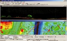
SeeByte Ltd has sold thirteen SeeTrack COIN (Common Operator Interface for NSCT1) systems to the US Navy Special Clearance Team ONE (NSCT-1) based in San Diego, Ca. with options for...
Merrick & Company has made available MARS FreeView, an intuitive, easy-to-use viewing application for LiDAR, high-resolution imagery and GIS datasets for free download. The application has several visualization tools and...
Trimble has introduced the VX Spatial Station, a positioning system that combines optical, 3D scanning and video capabilities to measure objects in 3D to produce 2D and 3D data sets...
We all know what is the oldest profession in the world. The second oldest is probably that of land surveyor: Adam undoubtedly wanted to stake out the boundaries of paradise...
Laser Bathymetry Conference On 13th November 2006 in Saint Petersburg the companies Chart-Pilot Ltd and GeoLIDAR held a scientific-practical conference on the theme of the opportunities for use of a...
This site uses cookies. By continuing to use this website, you agree to our Cookies Policy. Agree