h - 201704 - Bathymetric Lidar
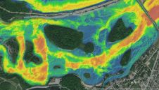
The Greater Montréal Area completed Canada’s largest-ever riverine topobathymetric Lidar survey in response to two major flooding events within the last five years, which together displaced tens of thousands of...
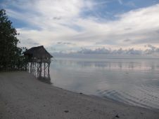
Experts are extremely concerned about the temperature of the Pacific Ocean, as the sea surface temperature this year was the warmest since satellite measurements began. This can have major consequences: for...
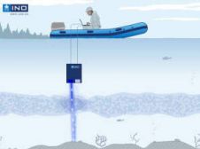
Canadian research institute INO has developed a submarine Lidar to measure the reflectance of the seafloor and water column. The system is used to determine the reflectance of the sea...
The RIEGL laser scanner company has been innovating laser scanning technology for more than 30 years. The equipment can be found in the most remote and even challenging locations across...
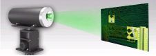
The INSCAN underwater laser imaging system has been presented by CDL, UK, and 3D at Depth, USA. The system provides fast, high-resolution 3D data capture for surveying, as-builts and monitoring,...
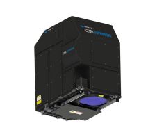
Teledyne Optech and Teledyne CARIS, both Teledyne Technologies companies, have announced their next-generation bathymetric Lidar, the CZMIL SuperNova. The CZMIL SuperNova is designed to boast the best depth performance and...
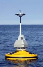
Fugro has chosen Global Offshore Wind 2012, held on 13 and 14 June 2012, for the launch of the group’s new Seawatch Wind Lidar Buoy, representing the next generation of...
Airborne Lidar (Light Detecting and Ranging) is a well-established remote sensing technique which scans the terrain and seafloor with high-frequency laser pulses. Until now, bathymetric Lidar data has been processed...
Bathymetric Lidar is a technique that is used to capture geospatial data of coastlines and waterbodies. The method has the potential to facilitate the fast and efficient creation of hydrographic data, and more...
This site uses cookies. By continuing to use this website, you agree to our Cookies Policy. Agree