[email protected]
SUBSEA 20/20, USA, was recently named an authorised sales agency for Blueprint Subsea, a UK hydroacoustic instrument manufacturer. An agreement of representation was formalised at the recent Ocean Business conference...
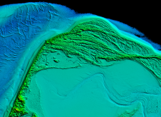
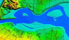
Arctia-Meritaito has efficiently produced a seamless digital terrain model of land and water along the shallow coastal areas of the German island of Sylt, using a Leica Chiroptera 4X airborne...
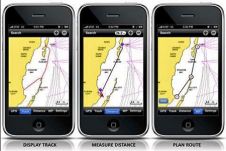
Navionics will be hitting the water with the newest version of our Mobile App created specifically for iPhone users. The charts are available for an expert mariner already familiar with...
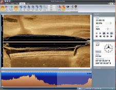
Tritech International Ltd announce the launch of the new StarFish, Scanline V2.0 Software. StarFish is a side-scan sonar which produces images of the seabed and has improved capabilities. Tritech are...
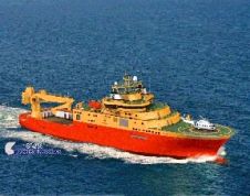
General Robotics is shipping DeepLive 2.0, its real-time data input module. The first customer is DeepOcean AS for its new Inspection, Maintenance & Repair (IMR) vessel, the Edda Fauna which...
Twenty years ago, Norcom Technology first began to develop their bespoke software for the hydrographic industry. The company started by Phil Harris in 1986 employed just one other computer programmer,...
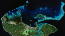
Bluesky International will use aircraft-mounted Lidar sensors to create a highly detailed 3D map of the whole of the Northern Ireland coastline. The Bluesky data will form part of the...
Coastal zones, situated at the intersection of land and ocean, hold immense social, economic and ecological significance. Currently, nearly 40% of the global population resides within 100km of the coast,...
This site uses cookies. By continuing to use this website, you agree to our Cookies Policy. Agree