Hydrus
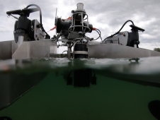
Hydrus is a micro-autonomous underwater vehicle that makes marine surveying easy and affordable. Hydrus takes the drone revolution underwater with the most advanced navigation and communication systems of any subsea...
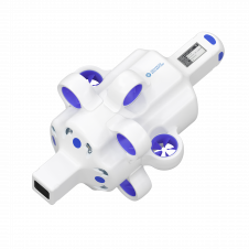
Hydrus is a micro-autonomous underwater vehicle that makes marine surveying easy and affordable. Hydrus takes the drone revolution underwater with the most advanced navigation and communication systems of any subsea...
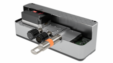
EM 2042 Multibeam Echosounder Small in size, but powerful in potential, the EM 2042 Multibeam Echosounder is efficient, light, robust and reliable: delivering high-density, high-resolution, clean data in the most demanding marine environments. With...
Teledyne Marine announces the inauguration of a service centre for autonomous underwater vehicles (AUVs) in Poland. Established in collaboration with Enamor, this venture underscores its ambition to deliver exceptional support...

Leading professionals from the ocean science and technology industries will gather at Oceanology International in London from 12–14 March. Oceanology International has announced a captivating lineup of esteemed industry leaders and...
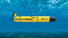
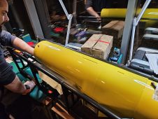
Teledyne Webb Research, a leading innovator in oceanographic research, has launched the Slocum Sentinel Glider, poised to make its debut at Oceanology International (Oi) in London in March 2024. The...
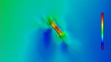
A 120-year-old mystery has been solved with the help of a CSIRO team aboard the RV Investigator. Heritage NSW has announced the discovery of the SS Nemesis, a 73-metre iron-hulled...
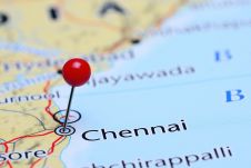
IIT Madras has established a Centre of Excellence (CoE) dedicated to advancing indigenous maritime technology and expertise. The team of researchers leading this initiative has been actively engaged in notable...
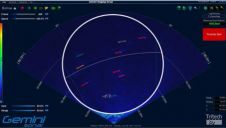
Gemini SeaTec, UK, provides an early warning of the presence of marine mammals in the vicinity of marine current turbine structures. The Gemini SeaTec system has been successfully field-tested on...
HydroSurv, a prominent provider of electric and hybrid uncrewed surface vessels (USVs), has successfully secured Innovate UK funding to advance the commercialization of an end-to-end seagrass monitoring solution. This endeavour...

The Danish Geodata Agency, alongside several collaborators, is currently conducting trials on the latest iteration of navigational charts in the Baltic Sea region. This initiative forms part of an EU-funded...
This site uses cookies. By continuing to use this website, you agree to our Cookies Policy. Agree