Found 120 results
Sort by

Navigating Through Land and Water

This year the Geodetic Institute of Slovenia is celebrating its 55th anniversary. As a public institution, the work of the Institute was and remains dedicated to geodesy, photogrammetry, cartography, geomatics...

Read more

Five-Year USACE Contract

Fugro Pelagos, Inc. (FPI) has successfully negotiated a contract with the United States Army Corps of Engineers (USACE), Mobile District to provide Surveying and Mapping Services in support of the...

Read more

Scanning Data Integrated in PDS2000

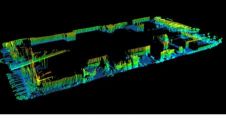
Fusing data sets from multiple sensors is a demanding requirements being seen more and more frequently in client specifications, typically combining photogrammetry or laser data with multibeam sonar data to...

Read more

Alaska – The Wild Coast

At the turn of the century, the West Coast fleet of the Coast and Geodetic Survey was comprised of a mélange of ships, some of which were not retired until...

Read more

Solving the Uncertainty Management Puzzle

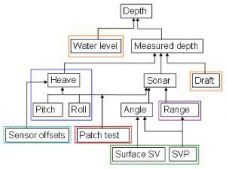
As shipping companies continue to make their operations more cost efficient and environmentally friendly, the demand for high density data has increased. Uncertainty management is a cornerstone to sound Geomatics...

Read more

Changing Times and Technology

As I reflect on my career of more than thirty years in the field of cartography, it is difficult to grasp the degree of change technology has brought to the...

Read more

Guidance on Subsea Metrology

A publication ‘Guidance on Subsea Metrology' (IMCA S019) from the International Marine Contractors Association (IMCA) turns the spotlight on subsea metrology, covering the basics of subsea metrology, engineering requirements, the...

Read more