Near Real-time Data from Dubai
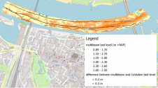
As part of its Coastal Zone Monitoring Programme, the Marine Works Unit of the Dubai Municipality has set up a website (www.dubaicoast.org) which enables viewers to watch near real-time video...
As part of its Coastal Zone Monitoring Programme, the Marine Works Unit of the Dubai Municipality has set up a website (www.dubaicoast.org) which enables viewers to watch near real-time video...
The esteemed Finnish Geospatial Research Institute (FGI) is set to utilize advanced Lidar systems developed by the Fraunhofer Institute for Physical Measurement Techniques IPM for future maritime surface surveys. Anticipating...
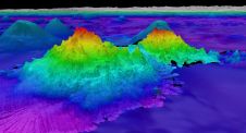
The crew of Schmidt Ocean Institute’s research vessel Falkor (too) recently discovered four underwater mountains – the tallest of which exceeds 2.4km in height – during a January transit from...
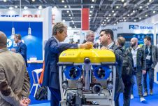
With innovation, progress and discovery at its heart, Oceanology International 2024 (Oi24) is preparing to welcome the world’s largest gathering of ocean professionals to the most powerful and inspirational event...
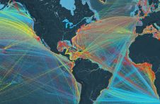
exactEarth has announced the launch of exactAIS Platinum Plus, the newest member of the company’s industry-leading exactAIS family of global real-time AIS vessel identification and tracking data services. The addition...

In a March 2023 blog, Microsoft founder, billionaire entrepreneur and philanthropist Bill Gates said: “The development of AI is as fundamental as the creation of the microprocessor, the personal computer,...
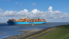
Imagine you’re a port pilot, responsible for the safe passage of a cargo ship that’s about the same size as an aircraft carrier. It’s the middle of the night, it’s...

In the annals of aviation history, a captivating mystery endures – the perplexing vanishing act of pilot Amelia Earhart. Renowned American explorer Tony Romeo confidently claims to have identified the...
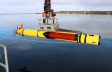
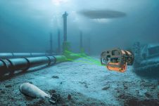
Hydroid, Inc., a subsidiary of Kongsberg Maritime and a leading manufacturer of marine robotic systems, has just announced it has integrated an in-mission processor on a REMUS 600 Unmanned Underwater...
CoVadem has created an up-to-date depth chart of inland waterways. The underlying data obtained came from vessels participating in the CoVadem initiative, each sharing their sensor data in the CoVadem...
This site uses cookies. By continuing to use this website, you agree to our Cookies Policy. Agree