Hong Kong Maps Tide in Real Time
The Hydrographic Office of the Marine Department in Hong Kong has launched a real-time tide map. It displays the real-time tides at eleven locations along the Hong Kong shore, from...
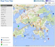
The Hydrographic Office of the Marine Department in Hong Kong has launched a real-time tide map. It displays the real-time tides at eleven locations along the Hong Kong shore, from...
C-Nav, USA, has launched its GNSS real-time tide measurement package, C-Tides. The suite combines the vertical accuracy of C-Nav's GNSS Precise Point Positioning service with ocean and coastal tide models....
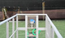
The 44th tide gauge for SHOM’s RONIM1 network has been installed in Port-la-Nouvelle, near Narbonne (France) on 29 May 2013. The installation improves the cooperation between the SHOM and the...
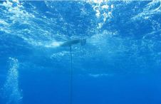
Liquid Robotics, USA, reports that one of its Wave Gliders named Mercury battled through Hurricane Sandy and successfully piloted through winds of up to 70 knots, while continuing to transmit...
Australia-based Fastwave has recently received orders for over 50 OceanStar telemetered marine environmental monitoring systems. Most of the systems are to be deployed as part of the broader marine environmental...
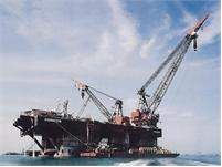
Metocean Services International (MSI, Australia) has recently completed a 7-month project for Heerema Marine Contractors Australia Pty Ltd (HMC) in connection with Woodside Energy Ltd’s North Rankin (NRB) development offshore...
The maximum detection range of the BlueView P450 Series 2D multibeam imaging sonar has been extended to 300 metres (984ft). Available with 45°, 90° or 130° field-of-view options, these forward-looking...
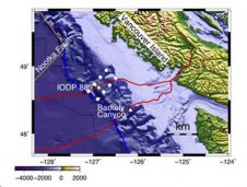
An interdisciplinary project led by Woods Hole Oceanographic Institution (WHOI) geologist Jeff McGuire, an expert in global earthquake seismology and geodesy, and John Collins, director of WHOI's Ocean Bottom Seismometer...
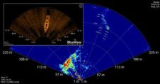
BlueView Technologies has launched a long-range imaging sonar with a wide field-of-view: the P450 Series, available in five models including two deep-water options. Each model has a maximum detection range...
Turner Designs introduces C-FINS (Fluorometric Integrated Nautical Mapping System), integrating the C3 Submersible Fluorometer's digital output with GPS data for data mapping. A simple software module enables C-FINS and ArcGIS...
This site uses cookies. By continuing to use this website, you agree to our Cookies Policy. Agree