
In the summers of 2021 and 2022, an iXblue DriX USV was deployed to try and locate the missing wreck of the sunken French fishing trawler Ravenel. The vessel disappeared in January 1962 with 15 people on board and was never found, despite extensive research campaigns.
In April 2021, the French Minister for the Sea announced the launch of a major research campaign, requesting that the DriX uncrewed surface vessel (USV) be used to map the seafloor off the coast of the Saint-Pierre and Miquelon islands. A dedicated crew was first sent by iXblue to operate the DriX and perform the survey in the summer of 2021, and then again in 2022. A Kongsberg EM2040-04 multibeam echosounder (MBES) system was installed in the DriX gondola for seabed mapping.
Conducted in coordination with local authorities, the survey mission also included archaeologists from the DRASSM (Departement des Recherches Archéologiques Subaquatiques et Sous-Marines), whose aim was to analyse the data collected by the DriX USV and inspect potential targets using ROVs.
During the two campaigns, DriX was used in autonomous mode under the supervision of a remote operator. The USV was monitored either from iXblue’s remote control centre in La Ciotat (south France) using 4G or Satcom or from a support vessel for operations conducted close to the shore.
Extensive Area Coverage Despite Challenging Survey Conditions
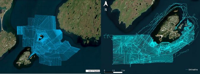
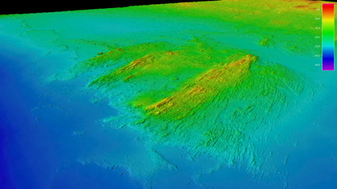
The uncertainty surrounding the exact time of the sinking led to the definition of a large research area: from outside the port of Saint Pierre to the Newfoundland coast for the 2021 campaign (450km2), and south of the islands of Saint-Pierre and Langlade for 2022 (400km2).
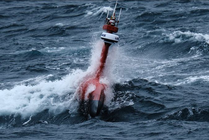
The environmental conditions in the area are known to be very challenging, even during the summer. Typically, sea conditions with a tidal current up to 2kn, wind gust up to 50kn, waves of 2.5m and an Atlantic swell up to 3.5m are to be expected. The presence of dense fog is another challenge in terms of situational awareness and obstacle management.
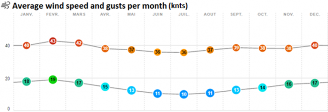
Statistics for wind (average wind speed in knots and gusts) per month for Saint-Pierre and Miquelon are presented below.
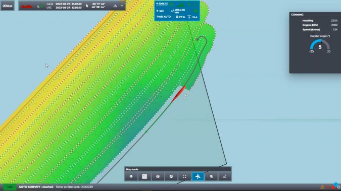
These difficult conditions did not prevent DriX from completing the full planned survey area within the allocated time frame. The map below shows the navigation lines performed by DriX during the 2021 (left) and 2022 (right) missions. This represents more than 11,000km.
The over- the-horizon operational mode and the complex environment required a high level of situational awareness. Navigation could be managed safely and efficiently owing to the DriX advanced obstacle detection and avoidance system that combines multispectral / multidistance perception means (camera, Lidar, radar, AIS) to detect, locate and track obstacles and provide a single unified georeferenced representation.
Optimized Acquisition and Delivery
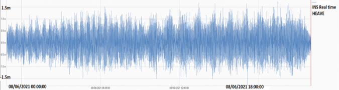
Despite the rough weather conditions, the unparalleled stability of the DriX and the data acquisition performance of the EM2040 resulted in high-quality multibeam data and a survey resolution up to five times better than previous surveys in the same area. The optimized data gathering environment made it possible to record very clean data. Over the 11,000km of survey line acquired, the post-processing phase did not require the use of any bathymetric automatic data filter or manual despiking, which vastly increased the processing time and fast tracked the data delivery to the DRASSM archaeology team.
Finally, the very low noise acoustic signature of the DriX gondola made it possible to maintain high-frequency recording and an optimized swath, even in deep waters. Therefore, the 400kHz MBES frequency was used from 5m to 250m depths, the deepest section of the survey area.
The survey was conducted between 7 and 8 knots, which provides the best compromise between sounding density versus area coverage efficiency for a given time objective.
In 2022, DriX’s new ‘auto-line’ feature was used for the first time. Auto-line is the ability of the DriX to decode the bathymetry provided by the Kongsberg multibeam system and to perform navigation autonomously based on the swath width. This new development allowed around a 50% gain in time for line planning and a 30% increase in operations, thanks to the swath optimization and overlap management.
This new software development allowed for tremendous gains to be achieved in the 2022 campaign, resulting in covering an area close in size to the one surveyed in 2021 but in much less time. The teams could therefore cover an additional survey area in the remaining time frame of the mission.
Another challenge was the operational coordination between the organizations involved. iXblue was conducting the survey in Saint-Pierre and Miquelon while the DRASSM was performing target identification and the ROV inspections. The DRASSM operation was fully dependent on the bathymetry interpreted from the DriX measurement. As the ROV inspection started before the end of the survey project, the bathymetric results needed to be delivered for review within two days after acquisition.
The data was therefore downloaded directly from the DriX computer to the control centre, where it was checked, processed and delivered to the DRASSM so that analysis and target picking could be performed.
This highly detailed bathymetric mapping of the area allowed the DRASSM to identify two high potential targets, both in French waters. The identification confirmed that the two targets were indeed shipwrecks, although visual inspection confirmed that they were not the Ravenel. Both wrecks were lying on the seabed at around 110m depth. The first one, around 40m long, the second one (image below), approximately 24m long. Both were made of wood. 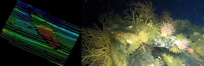
Conclusion
With over 11,000km covered, completing the full scope of work, the operations showed that using a USV such as the DriX represents a very efficient means of surveying, providing a highly reliable and high-quality survey in very challenging survey conditions.
Unfortunately for the 2021mission, the completion of the search area inspection did not provide any further information regarding the sinking of the Ravenel, For the 2022 each campaign, analyses are still ongoing, and so the mystery continues..