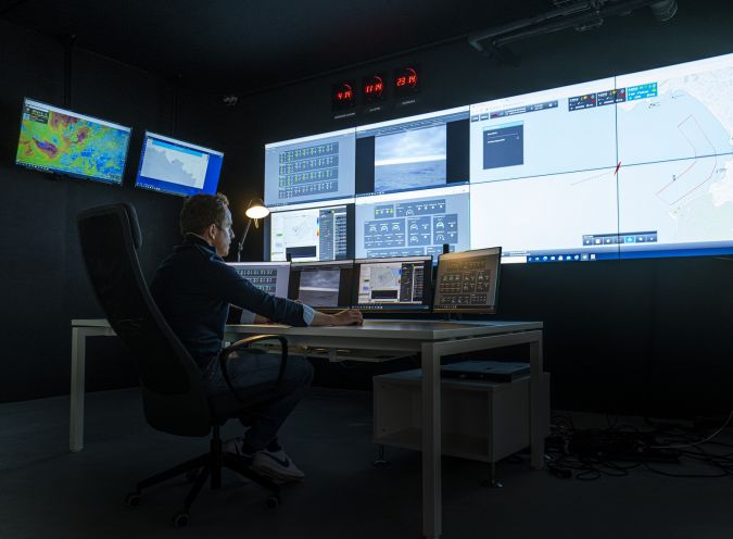
With the advances taking place in newly developed autonomous platforms, hydrography is accelerating its revolution towards a 4.0 industry. The deployment of uncrewed surface vessels means that human skills and expertise can be put to better use exploiting and qualifying the collected data, all from the safety of a remote control centre. Uncrewed survey platforms are able to cover extensive areas at a fraction of the time and cost of traditional survey methods, and they have become a leading-edge survey technology that force-multiplies data acquisition and helps optimize survey productivity, efficiency and safety as a whole, defining the essence of remote hydrography itself.
Hydrography is undergoing dramatic change. The current pandemic has made it very difficult to go to sea and mobilize vessels and crews, while the use of traditional research vessels is rapidly becoming obsolete as environmental regulations are introduced that are increasingly difficult to meet financially. At the same time, the blue economy is booming. International initiatives like Seabed 2030 are being implemented, and never before was there such a need to monitor not only seabed dynamics, but seabed ecosystems and water columns too. This involves collecting, processing, interpreting, plotting and archiving a massive amount of data in a more efficient and cost-effective manner. All of this requires a global change in the way that hydrography is conducted. And, while technology has evolved in that direction in the past decades, with major breakthroughs made in the fields of subsea monitoring and mapping systems, covering large areas of our seas and oceans in a timely fashion and within budget remains a challenge. This can now be solved with the advance of new purpose-made supervised autonomous platforms and remote hydrographic operations, which make it possible to use sensors to the best of their capabilities, providing ideal acquisition environments through enhanced stability, speed and reduced radiated noise.
Obligations and Responsibilities
In addition to the environmental responsibilities that the hydrographic industry has, it is also important for its societal role to be taken into consideration. Keeping surveyors out of harm’s way must indeed be a permanent goal, just like keeping the environment that we are serving safe from irreversible impacts. The transition towards the use of uncrewed surface platforms brings just that. Not only do such platforms reduce human exposure to hazardous environments, but they also enable more sustainable operations by consuming less fuel than traditional survey vessels, reducing greenhouse gas emissions.
The rise of autonomous platforms also allows operators to either enhance the capability of their exploited assets by acting as force multipliers, or to benefit from a single low investment and low operating costs for those who cannot afford large investments.
The hydrographic industry’s societal role also extends to granting easier and less expensive access to assets and acquired hydrospatial data for a larger community, including scientists (e.g. marine biologists, oceanographers, archaeologists, geologists), fishermen and other actors in the blue economy. This should be among the industry’s priorities, and can now be met through the increased deployment of advanced autonomous survey platforms that widen operating windows, enabling much larger amounts of data to be collected.
Solutions and Challenges
Thanks to the advances taking place in these newly developed autonomous platforms, hydrography is now accelerating its revolution towards a 4.0 industry. With the deployment of uncrewed surface vessels (USVs) that remotely conduct recurrent tasks such as data collection, human skills and expertise can now be put to better use exploiting and qualifying the collected data, all from the safety of a remote control centre, either on a mother vessel, or at an onshore location. This evolution not only involves technology, but also requires rethinking the whole concept of the hydrographic ‘operation’. Greater progress will indeed be made once developers and service providers adapt their survey methodology to the use of these new remotely supervised platforms.
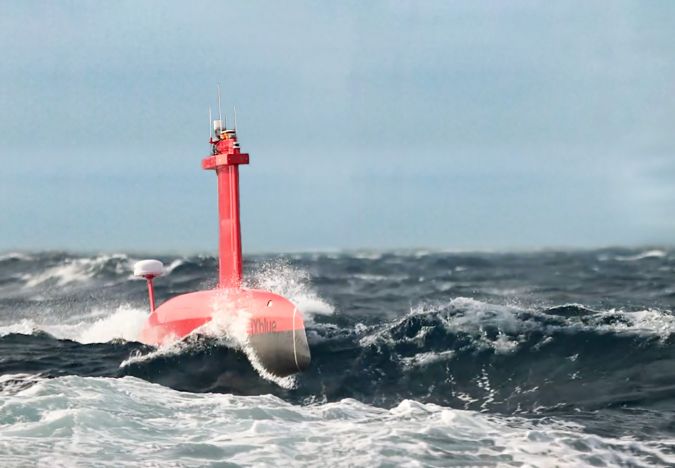
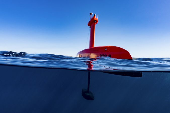
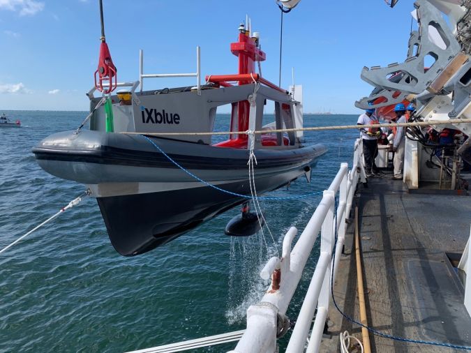
Autonomy is key in the response to the previously made observations. Making use of purpose-built platforms, the design of which is based purely on their end function (data acquisition), plays a big role in this transition. Leveraging purely hydrodynamic designs that do not have to be constrained by human presence onboard the vessel, USVs benefit from high stability that allows them to work at greater speeds and in higher sea states than traditional survey platforms, while still acquiring higher quality data. Among the possibilities brought about by uncrewed vessels, modular gondolas – such as the ones developed by iXblue for the DriX USV – indeed provide unique low noise environments away from hydrodynamic acoustic turbulence, and guarantee cleaner acoustic data.
Developing an ecosystem around autonomous platforms is also key to the smooth transition towards remote autonomy, as it enables efficient deployments and successful missions without creating new operational constraints. Aware of this challenge, iXblue is developing a full ecosystem around its DriX USV, consisting of functional launch and recovery systems, as well as purpose-made towing tools, gondola adaptations and shallow water support tools.
Overall, uncrewed survey platforms, which are able to cover extensive areas at a fraction of the time and costs of traditional survey methods and keep downtime to a minimum, have become a leading-edge survey technology that force-multiplies data acquisition and helps optimize survey productivity, efficiency and safety as a whole, defining the essence of remote hydrography itself.
Supervised Autonomy
Supervised autonomy is defined as the ability to operate unmanned surface platforms autonomously to achieve high-level mission goals while they are supervised by a remote operator who can take over control whenever circumstances require. In the context of hydrography, mission goals are usually defined by an area to be surveyed, as well as by measurement objectives (e.g. coverage, measurement density). A mission consists of the sequential execution of autonomous behaviours that represent elementary tasks. Most uncrewed platforms operate with deterministic behaviours, such as following run lines or predefined survey patterns. One of the challenges to reach the next level in terms of autonomy will be to develop reactive autonomous behaviours that use the data collected by the payload to optimize the platform mission plan.
The need for supervision is driven by the technology readiness and societal acceptance. As with self-driving cars, the path towards full autonomy will consist of multiple steps. Of course, autonomous systems use advanced communication systems to provide pilots with a high level of situational awareness, and communication in the maritime environment remains a challenge, as the performance of marine communication systems can vary greatly depending on the environmental conditions. USVs have to rely on a wide range of communication infrastructures, depending on the operation scenarios (Wi-Fi, radio, LTE or satellite). Managing the User QoE (Quality of Experience) also remains a significant challenge.
To respond to the challenge of optimizing the use of available communication channels, iXblue has been working on an adaptive strategy in terms of managing the transfer, remote processing and access to data according to user priorities. Another choice made by iXblue to offer an adaptive strategy is its developments on the DriX USV command and control. Built as an open platform, it supervises third-party software to use onboard data processing and management to its best capabilities, while continuously accessing and integrating the right amount of data required to make decisions that support supervised autonomous operations.
The flexibility provided by this kind of open platform allows the best adaptation to the constraints linked to communication channels to support supervised autonomy, while maintaining a very high level of onboard autonomy and responsiveness to potential working environment and situational changes.
Opportunity for New Generations of Sailors and Scientists
Overall, the transition to remote hydrography will call for a new generation of marine technicians and scientists that will need to be trained to support uncrewed platform mobilization, operation and maintenance, as well as to support the increasing need to interpret the massive amount of data collected.
While traditional survey vessels were crewed with sailors in charge of navigation and deck operations, as well as with onliners and offliners for data acquisition, mission planning, data processing, pre-interpretation and charting, uncrewed survey platforms will now require a smaller team of a new kind of technicians. True specialists in autonomous platforms and remote operations, they will organize field mobilizations, liaise with local authorities and communities, and be able to maintain autonomous platforms.
And because autonomous survey platforms provide higher data quality – iXblue DriX’s latest remote operations have indeed shown a reduction by a factor of ten of the required cleaning and processing of hydrographic data – more time will be given to onliners and offliners to concentrate on much added-value QC, interpretation and charting tasks. Globally, using uncrewed vessels such as the iXblue DriX USV supported by a strong ecosystem will not only save precious time during these phases, but also during all other stages of the survey operation, including mobilization, thanks to smaller pre-calibrated and normalized platforms, and during the operation itself, thanks to the development of efficient mission planning algorithms and autonomous data acquisition. All of this allows onliners and offliners to work remotely on multiple assets and missions at the same time, bringing much added value to the industry.
“Hydrospatial is the branch of applied sciences which deals with the analysis, understanding and access to static and dynamic marine geospatial digital and analogue data and information, digital signals, measurement and description of the physical, biological and chemical features of oceans, seas, coastal areas, lakes and rivers from all possible available data sources in near-real time and real time, including their history and the prediction of their change over time. This for the purpose of: timely access to a standard, high-quality and the most up-to-date marine spatial data infrastructure; safety and efficiency of navigation; and in support of aquatic and marine activities, including sustainable blue environment and economic development, security and defence, and scientific research.” Denis Hains – What Is ‘Hydrospatial’?