Much More Than a Typical Hydrographic Office
Hydro International Interviews Capt Brian Connon, Director NGA Marine Safety Office
In October 2015, Capt Brian D. Connon assumed the role of director of the National Geospatial-Intelligence Agency’s Maritime Safety Office. The organisation is an important, although not always visible, link in the global maritime safety chain. Its work contributes to generic marine safety and, due to the nature of the data collected and analysed, its role is especially relevant for security, humanitarian assistance and disaster relief. In this interview with Hydro International, Capt Brian Connon lays out the role of hydrographic data and technologies in the NGA.
Can you briefly outline the work of the NGA?
The National Geospatial-Intelligence Agency (NGA) is the United States’ primary source of geospatial intelligence (GEOINT) for the Department of Defence (DoD) and the US Intelligence Community (IC). GEOINT is the exploitation and analysis of imagery and geospatial information that describes, assesses and visually depicts physical features and geographically referenced activities on the Earth. As a DoD combat support agency and a member of the IC, the NGA provides GEOINT, in support of US national security and defence, as well as, humanitarian assistance and disaster relief situations.
What does this mean for hydrography or oceanography?
Basically, the NGA is an authoritative source for maritime data, products and services, including global maritime safety information and nautical publications and charts, both digital and paper. The geospatial information that the NGA provides has been defined as: information that identifies the geographic location and characteristics of natural or constructed features and boundaries on the Earth and includes statistical data and information derived from, among other things, remote sensing, mapping, and surveying technologies; and mapping, charting, geodetic data, and related products. Therefore, when one thinks about the collection of data and the degree and diversity of information that is analysed and included in a nautical chart or publication, one can see how hydrography and oceanography play critical roles in the compilation of these products.
What are typical products of the NGA? Are they available for civic use?
Like most Hydrographic Offices, the NGA maintains a comprehensive database of maritime information. From this, we develop a portfolio of charts and publications, as well as other products and services, based on the requirements of our customer, in this case, the Department of Defence. We maintain worldwide coverage in both Standard Nautical Charts (SNC) and our electronic chart, the Digital Nautical Chart (DNC), which is similar to the Electronic Navigation Chart (ENC) in content, but very different in format. The DNC was chosen many years ago to serve the needs of DoD due to its Vector Product Format (VPF), which was already in use by our topographic counterparts. Regarding civil use, the majority of the NGA’s SNC and DNC portfolio is limited to DoD use only, although we do have a small number of SNCs available for public sale in areas of the world where the NGA is recognised as the primary charting authority. Electronic access to databases and products is available. The site includes US Notice to Mariners and other selected publications in PDF format, a marine navigation calculator and corrections to the NGA, NOS and US Coast Guard hydrographic products.
What is the specific task of the Maritime Safety Office?
The Maritime Safety Office collects, evaluates and compiles worldwide marine navigation products and databases. This mission is anchored in statutory law under US Code Title 10 which states in part that the NGA shall improve means of navigating vessels of the Navy and the merchant marine by providing, under the authority of the Secretary of Defence, accurate and inexpensive nautical charts, sailing directions, books on navigation, and manuals for instruction for the use of all vessels of the United States and of navigators generally. Publications include the US Notice to Mariners, Sailing Directions, NGA List of Lights, US Coast Guard Light Lists, American Practical Navigator (Bowditch) and other navigation science publications. One of our most important tasks is our role as a NAVAREA Coordinator for the Worldwide Navigational Warning Service’s NAVAREA IV and NAVAREA XII safety messages, an essential part of the Global Maritime Distress and Safety System. We maintain a 24/7 Maritime Safety Watch that monitors events not only within our assigned NAVAREAs from other national authorities for promulgation to both civilian and military mariners but also worldwide from all NAVAREA Coordinators to inform our US military customers of emergent impacts to safety of navigation around the globe.
The Maritime Safety Office is an active participant and leader in international forums, including the subcommittees and working groups of IHO’s Inter-Regional Coordination Committee (including Regional Hydrographic Commissions) and Hydrographic Services and Standards Committee, as well as, many other organisations related to maritime safety, hydrography, oceanography, and bathymetry.
How does the NGA’s mission support the NOAA objectives?
The NGA, NOAA, the US Navy, and other US government agencies are committed to improvements in hydrography, nautical charting and maritime safety. It can be confusing to see different US agencies at meetings, but we all work very hard to provide a common US perspective. We meet regularly to discuss strategic objectives, opportunities to burden share, and the future of hydrography in the US and abroad. In some areas of the world, like the Arctic, we have to work very closely to ensure both national and defence objectives are addressed. At the technical level, our personnel are in frequent contact to exchange data, processes and ideas.
Does the NGA conduct its own hydrographic surveys? If so, how is it organised?
The NGA does not conduct organic hydrographic surveys. We rely on our partnerships to provide the data required to maintain our portfolio. Our primary sources of hydrographic survey data are the Naval Oceanographic Office and the Fleet Survey Team, who conduct hydrographic surveys worldwide in support of DoD. We do occasionally contract surveys in areas of highest priority, but that is not common.
Does the NGA make use of datasets from other sources? Is there a quality requirement?
The remainder of our source data comes from other US government agencies, such as NOAA and US Army Corp of Engineers, agreements with international Hydrographic Offices, publicly available sources, and satellite imagery. Before any source data is used in our products, it is evaluated very carefully for quality and suitability for use. Today’s challenge is to embrace new data sources, such as, Volunteer Geographic Information, satellite derived bathymetry and crowdsourced data, while ensuring sufficient quality for intended use. In the end, there is a subjective determination of risk that must be made before adding these data, a determination as to how to portray this type of data, and a method to communicate the risk to the customer in the final product must be developed.
How do you judge technology like satellite derived bathymetry or at the other end of the scale – marine autonomous systems?
We are very involved in the evaluation of remotely sensed data for use in hydrographic products, including satellite derived bathymetry (SDB). SDB is a fascinating technology that the NGA is very excited about for use in our production process. The ability to remotely assess areas without utilising expensive ship or aircraft survey time is certainly a huge benefit. There are drawbacks, of course, to using this technology. Not every area of the world is conducive to SDB collection, not everyone has access to the satellite data and algorithms to make it work, and, finally, SDB may not be suitable for updating certain products.
Autonomous underwater vehicles (AUV) and autonomous surface vehicles (ASV) are certainly coming into their own and are becoming much more common in the inventory of Hydrographic Offices. The two biggest challenges for these systems, in my opinion, are battery life and positioning. In the early days of ‘unmanned systems’, a ship was dedicated to launching, monitoring, and retrieving AUVs with very short operational cycles. Improvements to battery life have greatly extended mission length, which necessitates improved navigation and positioning systems. Integrated GPS and inertial navigation systems (INS) are meeting the challenge to maintain IHO accuracies throughout much longer submerged missions. Now, multiple vehicles can be launched without requiring a ship to remain in close proximity, allowing for substantial gains in survey efficiency. I am looking forward to small, unmanned aerial vehicles outfitted with imagers and a Lidar system to provide fast surveys along the land-sea interface.
I imagine future survey vessels will carry several of these autonomous systems, but will still require highly trained hydrographers to plan the mission, operate the vehicles, and process the data.
Is there a change in the NGA’s role in time? What are typical items these days?
Over the years, the largest change for the NGA has been the transition from paper to electronic charting and now the advent of a data centric approach. Since 2004, NGA has maintained a worldwide vector product and we are very excited to see global vector coverage in the commercial sector becoming a reality.
Our goal now is to transition away from DNC to ENC, in concert with our customer base, which will greatly improve our ability to collaborate with other Hydrographic Offices, accelerate chart production, and improve overall safety of navigation for our customers. There is so much more that can be provided for maritime safety, naval operations, and commercial shipping in the form of Marine Information Overlays (MIO) and Additional Military Layers (AML). Providing weather and ocean forecasts, Notice to Mariners, routing information, etc. in an efficient data package to a ship’s ECDIS is a powerful capability that will greatly enhance safety at sea. In addition, the presentation of electronic charts in a three dimensional context, the inclusion of time varying data, and the incorporation of real-time AIS data from navigational aids and even portrayal of virtual aids to navigation into a consolidated display for the mariner offer exciting opportunities in how traditional navigational products of today will transform in the future.
We are also focusing heavily on the Maritime Spatial Data Infrastructure (MSDI) initiative which will allow all of the hydrographic data and information held at the NGA to be used for purposes other than charting. MSDI is critical for governance of activities like coastal zone management, fisheries, and pollution response, just to name a few.
How should (or can) hydrographic professionals work with the NGA?
The NGA is a willing partner and has agreements with many international and commercial partners. We are always looking for new production technology, additional data sources, and collaborators who share our commitment to improving navigation for the mariner and making maritime information easily accessible to those who need it.
In addition, the NGA is a great place to work! You are exposed to so much more than a typical Hydrographic Office due to our unique and global DoD mission. There are always opportunities to apply for positions as a nautical cartographer, marine analyst, bathymetrist, or data steward.
More information
Electronic access to data and databases
http://msi.nga.mil/NGAPortal/MSI.portal
NGA Maritime Safety Office Vacancies
https://www.nga.mil/Careers/Pages/default.aspx
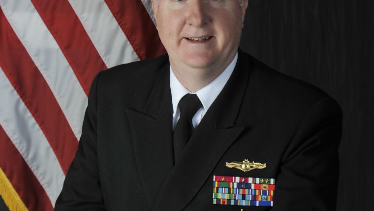
Capt Brian D. Connon assumed the role of director of the National Geospatial-Intelligence Agency’s Maritime Safety Office. Prior to his arrival, he served as the superintendent of the US Naval Observatory. Previous duties include deputy Navigator of the Navy, deputy Oceanographer of the Navy, and commanding Officer of the Navy’s Fleet Survey Team. A certified hydrographer, he holds a BSc in Geography from the University of South Carolina, an MSc in Oceanography and Meteorology from the Naval Postgraduate School in Monterey, CA, and an MSc in Hydrography from the University of Southern Mississippi.

Value staying current with hydrography?
Stay on the map with our expertly curated newsletters.
We provide educational insights, industry updates, and inspiring stories from the world of hydrography to help you learn, grow, and navigate your field with confidence. Don't miss out - subscribe today and ensure you're always informed, educated, and inspired by the latest in hydrographic technology and research.
Choose your newsletter(s)


