Talking about hydrographic revolutions
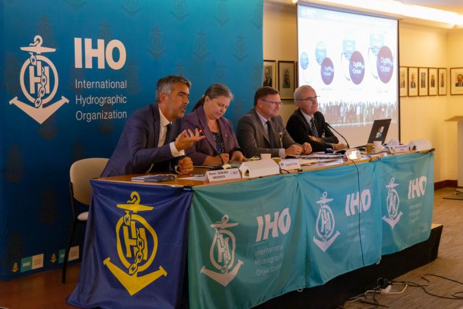
Over the years, hydrography has experienced several revolutions, both in terms of technology and standards, which culminated in November 2022 in the IMO adopting a Resolution on Performance Standards for Electronic Chart Display and Information Systems (ECDIS). This brings S-100 and related products a step closer to becoming reality at sea and these, in turn, will pave the way for autonomous navigation and a complete digital twin of the ocean. But how did we get to this stage? What were the main innovations that brought us to where we are today?
The first revolutionary development in hydrography came as hardware. The German physicist Alexander Behm was granted patent no. 282009 in July 1913, which referred to a method for measuring ocean depth based on sound and echo intensity. Before this, Behm had developed photographic recordings of sound propagation based on experiments in an eight-litre aquarium to study sound propagation in water. In the best engineering tradition, Behm continued his experiments, and in the years to follow he developed a working echosounder based on the echo time and his short time meter, with which he measured the smallest time units in a technically simple and onboard way. In 1922, hydrographic surveying made a quantum leap with the introduction of hydroacoustic methods for measuring water depths. It is no coincidence that the establishment of the precursor to the IHO in 1922 – the International Hydrographic Bureau – took place at the same time as the introduction of electronic solutions for systematic surveying of the seabed. The annual bulletin of the Bureau – the International Hydrographic Review – was full of articles over the following decade discussing the new opportunities that this technology brought to civil and naval applications.
Chart standardization
Moving forward another 50 years, the publication highlighting the 50th anniversary of the IHB in 1971 announced the first steps towards the creation of an international series of nautical charts – the INT charts. Based on an agreed cartographic representation of natural and anthropogenic features in the marine environment and a common symbology associated with them, this series aimed to create a consistent global portfolio of bilingual nautical charts underpinning the rapid globalization of sea trade and supporting the safety of life at sea. The INT chart standardization became (and still is) one of the pillars of the IHO as a standardization body. The introduction of the INT charting scheme was not only a great achievement in standardization, but also marked the end of the dominance of a handful of chart-producing nations running a global portfolio in their mother tongue. INT charts became a symbol of national sovereignty and pride for countries that had never before engaged in surveying and mapping of their domestic waters. They were therefore the main driver of the now 98 coastal states that constitute the IHO and that are committed to international cooperation based on agreed technical standards.
It took approximately two decades before the INT process was in full motion. At this time – late 1980s, early 1990s – another revolutionary development appeared on the horizon, once more driven by hardware but now combined with a completely new element: software. The approach to bringing digital nautical charts onboard was remarkable since it was top-down. The IMO and IHO created performance and technical requirements for the functions of this new device: ECDIS. IHO Standards for the format and presentation of the data content were successfully tested for prototypes, but motivating national Hydrographic Offices to regularly produce data in S-57 ENC format proved difficult, so that the ‘fuel’ for these off-the-shelf computer-based devices was inadequate. This changed as companies conquered the market with payable systems offering all the advantages that electronic (or, as we say today, ‘digital’) navigation holds, and high-quality and up-to-date nautical chart data coverage has been achieved as Hydrographic Offices have added ENCs as products to their traditional paper chart portfolios. Today, about 70 national Hydrographic Offices produce and disseminate ENCs for their waters. The market is fed by a collaborative trio of data producers, private data providers and OEMs delivering the onboard ECDIS devices.
ENC/ECDIS is one of the best examples of global technical standardization led by intergovernmental organizations, here the IMO and the IHO, in collaboration with industry. The top-down approach bore results in the end but needed a push from industry. Soon after consolidation of this technological approach from the late 1990s, hydrography got another boost – this time from the larger community of marine stakeholders.

Taking ECDIS to the next level
In spring 2022, the IHO submitted draft amendments for consideration to IMO’s Sub-Committee on Navigation, Communication, Search & Rescue (NCSR) on Performance Standards of ECDIS (MSC.232(82)). The IHO initiative included engagement with Member States and international organizations (CIRM, IEC and INTERTANKO) during the preparation of the proposed amendments to resolution MSC.232(82). NCSR9 endorsed the revised ECDIS Performance Standards in June 2022 and submitted them to the IMO Marine Safety Committee (MSC) for adoption. On 11 November 2022, MSC106 adopted the Resolution on Performance Standards for Electronic Chart Display and Information Systems (ECDIS), thereby making the use of S-100 and its related products a reality for improving safety of navigation. S-100 ECDIS will be legal to use after 1 January 2026 with a transition phase until 1 January 2029, when all new systems must comply with the new IMO Resolution on ECDIS Performance Standards.
IMO’s final approval marks the end of a long process to enable the IHO S-100 concept to become an inherent part of the IMO regulatory framework for international shipping. Its strategic relevance cannot be underestimated. This decision reaffirms the instrumental role of the IHO as IMO’s partner in the integration of hydrographic elements into the next phase of the digitalization of sea transportation. S-100 is a revolution in software. Based on the ISO 19000 Standards series for geoinformation, it has the potential to overcome the paradigm of frozen functionality of the first generation of ECDIS through standardization. S-100 derivatives can breathe, which means that constant update mechanisms such as those in smartphone app technologies will become common for software in the marine domain. Moreover, the multitude of data formats carrying content such as bathymetry, aids to navigation and ocean weather will always be interoperable, so that they can be meshed by end-user devices to fit the purposes of the wider user community. S-100 derivatives are democratic, as the various data formats are hosted on the web, and their home is the IHO’s S-100 Geospatial Information Registry. Interested communities, of which there are potentially many, can register and maintain their own formats and export tools for integration in dedicated software applications: IALA and WMO are two major partners bringing the S-100 concept to the field.
Because of the strategic importance of this work, the IMO invited the IHO to keep it informed on the development process of the IHO S-100 framework standard. Taking ECDIS technology to the next level will be instrumental for progress in supporting green shipping and the blue economy.
The S-100 mechanism and its derivatives are inherent to two more revolutions: autonomous navigation and the digital twin of the ocean, which are more closely connected than they may at first appear. Autonomous sea operations require machine-to-machine data exchange and automated decision-making. These are core characteristics of digital twins, which are virtual representations of physical objects and systems (in this case the ocean or a part of it) and have in the past been widely applied in the engineering realm for tasks such as engine optimization and port management. Digital twins include predictive and data-driven models that users can interact with to support their needs. Digital twins thus provide the ability to make informed operational, management and policy decisions for the real twin. This calls for data standardization as the basis – data standardization being one of the IHO’s strongest competencies. The IHO strategy embraces all these themes, which are expressed in the IHO’s 2023 motto: Hydrography – underpinning the digital twin of the ocean. To make this a reality, the IHO will focus on its S-100 Implementation Roadmap for the rest of this decade.


Value staying current with hydrography?
Stay on the map with our expertly curated newsletters.
We provide educational insights, industry updates, and inspiring stories from the world of hydrography to help you learn, grow, and navigate your field with confidence. Don't miss out - subscribe today and ensure you're always informed, educated, and inspired by the latest in hydrographic technology and research.
Choose your newsletter(s)


