The Impact of the Physical Properties of Water in Dam Lakes
In Accordance with the Results of the Echo Sounding and Reservoir Capacities
Technical managers and users of hydrographic surveying results of reservoir dams mainly pursue the amount of sedimentation and the authentic volume of the reservoir under their management. But to what extent is the data obtained reliable?
It would appear that the following factors could be effective in gaining this objective:
- Technical, modern and updated hydrographic guidelines,
- Advanced equipment and their appropriate application,
- Timely calibration during equipping and the elimination of systematic errors,
- Qualified, experienced, trained and specialised manpower,
- The application of methodology, according to the hydrographic guidelines of the reservoir,
- Correct data processing, including the enforcement of the essential amendments and the rendering of the same in a desirable mode,
- Field and technical surveillance on hydrographic surveying by the authorised authorities.
Applying the above-mentioned aspects guarantees that hydrographic surveying will to a large degree be correct. This article attempts to discuss and survey one of the most vital factors leading to the accuracy of hydrographic tasks. The calibration of the echo sounder equipment and the accuracy with which the hydrographic surveys are performed affect the volume and sedimentation analyses of the reservoir.
In automatic hydrographic methods this process is extremely simple and uncomplicated. In order to get a perspective of this matter, i.e. a change in the sound velocity of water in the dam lakes, one should be acquainted with the limnology of dam lakes.
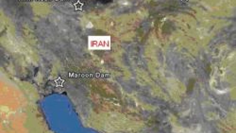
In addition to the survey of this aspect and its impact on the sound velocity variations, for this article hydrographic surveys were taken in the lakes of dams, namely, the Maroun Dam (Khuzestan Province), Karaj Dam, (Tehran Province), Maku Dam (Western Azerbaijan Province) and the Torogh Dam (Khorasan Razavi Province), which encompass varied climatic conditions (Fig.1). It is usually recommended that the hydrography of the lakes of dams should be performed during the period of maximum water level, which is normally in spring. The surveys of the mentioned reservoirs were conducted in spring when the water levels were highest. Due to drought, however, the Torogh Dam Basin had a water level of 1,195 metres. The maximum water level attained is 1,217 metres. This amount is equivalent to one-fifth of the total volume of the reservoir capacity.
Firstly, the general conditions and physical specifications of the dam lake reservoir waters shall be discussed, followed by the impact of these factors on the hydrography of the reservoirs under consideration.
Physical Properties
The depths of water bodies of more than a few metres are greatly inclined to stratification. The cause of the phenomenon is the modifications of water density arising from the changes in temperature and the deposition or sedimentation of suspended material. Thermal stratification is a general and common phenomenon, which is due to the temperature of solar radiation on the water surface, leading to a three-layer system, consisting of the following:
- A vertical layer composed of warmer water with an abundant quantity of oxygen known as Epilimnion,
- A region with steep temperature and density gradient known as Metalimnion and
- The underlying or lower layer, which is colder, darker and devoid of sufficient oxygen. This region is known as Hypolimnion (Fig. 2).
The thermocline is a relatively narrow region in which the maximum rate of decrease of temperature with respect to depth takes place. This area is recognised as a section of the Metalimnion region. Metalimnion also consists of a part of the thermocline and parts of the proximate water column, namely, the transition region, encompassed between the surface and deep water regions.
In most of the enriched lakes, the Hypolimnion has been specified as an anaerobic region, because in this section the lake bed demands a higher amount of oxygen due to the decomposition of organic sediments. The 1°C difference in density, involves a change in a 24° temperature, which is three times over the density difference, in a temperature of 9°C. Hence, the thermal stratification in tropical regions is extremely intense compared to that of the reservoirs with meager gradients of temperature. Potential density changes arising from suspended material, from the viewpoint of being greater in amount, are those that have an impact on the change of temperature and are liable to bring about the presence of a concentrated, muddy and a warm flow in the infra sections of the colder portions of water throughout the lake reservoir. This flow is often recognised as density flow which is muddy. In some of the reservoirs, concentrated flows could lead to the transportation of an immense amount of sedimentation behind dams.
Seasonal Impacts
Stratification of lake reservoirs is created as a result of various factors, including solar energy, warm water flows and the concentration of suspended material. If temperature profiles are measured throughout the year, the summer shows thermal regions of the reservoir dam lake with considerably fortified stratification due to the temperature of the solar radiation on the water surface. In the winter a consistency in the thermal temperature within a column of water is seen. By overlooking the density gradient and in assuming the water composition in one column of water, a phenomenon known as 'turnover' is witnessed, during which, enriched materials which have collected in the deeper layers approach the water surface. During the spring season, when the temperature is higher in these areas, days are longer and the frost disappears from the lake surface, the growth of algae is stimulated. A lake that does not freeze and has a mixed or combined period annually is known as monomictic. Lakes which are covered with ice in winter and display a combination in autumn and spring are known as polymictic.
Wind is the initial factor that creates a vertical circulation in the dam reservoirs. Stronger winds cause a deeper circulation and deepen as well as increment the Epilimnion strata. The thermal structure of a lake can be greatly affected by a change in direction and be confronted with the velocity of wind. Winds that are strong enough to blow for a sufficient period and have a vast fetch can influence the structural thermal stratification and bring about an absolute interchange or mixture in a column of water. The lakes of reservoir dams, as is the case in natural lakes, are affected by such winds. In addition, smaller reservoirs can also be completely exposed to the turbulence of larger flows or currents and new waters can replace the older ones. This fresh turbulence, due to the thermal solar radiation, can result in the water surface being prone to a thermal stratification in a column of water repeatedly.
Density of Water
The density of water can be in the form of density affiliated to the thermal temperature of water, or to supplementary density arising from non-solvent materials and suspensions, which can be expressed by the following formula:
Where is density (kg/m³), T is temperature; Ts is the total non-solvent materials and ss stands for suspended solids. The maximum density of water is equivalent to 1,000 (kg/m³) at a temperature of 3.98°C. Changes in the density occur from the temperature and suspended materials in the water which gives rise to variations in the velocity of sound in the lake waters of reservoirs.
Speed of Acoustic Waves
The speed of sound waves in fluids can be expressed as follows:
C=√ κ/ρ
Here, κ and ρ are the volume elasticity and density, respectively. For fresh water at a temperature of 20°C, ρ = 988kg/m3 κ = 2180,000,000N/m and C = 1447.9m/s.
None of the parameters of and are constant, but are all subjected to changes in pressure and chemical composition of the water. The velocity of sound is computed according to metre per second (m/s). Alterations in the velocity of sound directly depend on the changes of the physical parameters of water. The most crucial factor in changes of sound velocity is temperature. The velocity of sound in the lake waters of dams is normally from 1,410 to 1,510m/s. This depends on the physical conditions of water which fluctuate.
Volume Error
Fig. 3 demonstrates the variations in the velocity of sound in the four reservoirs surveyed. The Maroun Dam is in the tropical region, in the south of the State. The Maku Dam is in a cold region in the southwest, whereas, the Amir Kabir and Torogh Dams are in the north and northeast of the State studied (Fig. 1).
The Maroun Dam is one with a higher volume capacity and the Karaj, Maku and Torogh are seen as dams with lower capacities. Table (1) gives information on the depth, velocity of sound, level and volume of the above-mentioned dam lakes during the measuring period. Volume errors calculated in the mentioned dams have been shown in Table (1) by computing the velocity of sound as 1,500m/s. The range of error arising from the velocity of sound in calculating the volume of the reservoirs of dams under study is between 2 and 4 percent. In cases in which the velocity of sound utilised in the echo sounder is higher, this error shall increase. On average, an error equating to 3 percent of the reservoir volume should be expected in computing this. Normally, this amount of error is more than the amount of annual sedimentation in most of the reservoirs. For example, the average amount of annual sedimentation afflicting the Maku Dam Reservoir was 2.307Mm³ from the year 2003, (the initial hydrography) until the hydrographic operation performed in the year 2008 was estimated to equate to 11.54 (cubic million metre) Mm³, whereas, an error resulting from including an incorrect velocity of sound equalising to 4.142Mm³ which is approximately double the amount that has been calculated annually. While, the amount of annual sedimentation of the Karaj Dam Reservoir has been estimated to be equivalent to 0.712Mm³ per annum. The error occurring from the velocity of sound in calculating the volume of the Karaj Dam Reservoir is 5.325Mm³.
With regard to the Maroun Dam, which has a relatively larger reservoir volume, the amount of its annual sedimentation has been estimated to be approximately 10.6Mm³, whilst the error occurring from the velocity of sound in computing the volume of the reservoir was estimated as 18.6mm³. This amount of error in echo sounding operations makes the issue of sedimentation measuring and determining the volume of the reservoir futile. On the other hand, the amount of annual sedimentation of the Torogh Dam Reservoir has been estimated as 0.34920 million tons. The error arising from the velocity of sound in calculating the volume of the Torogh Dam Reservoir is 0.233000Mm³. The measuring performed on the Torogh Dam was conducted when the level of water present was 1,195 metres (from the mean sea level), whereas, the normal level of the dam was 1,217 metres. The volume of the dam at a normal level equated to 34.91Mm³ and the volume relative to the surveying level is 1,195 metres equating to 7.3Mm³. This means that the hydrographic surveying was performed during a period when the reservoir benefited from a capacity of 20 percent. This figure demonstrates how hydrographical and computation results of sedimentation including the volume of reservoirs can be utilised, despite such colossal costs.
Conclusion
As observed, determining the velocity of sound in hydrographic surveys is of vital importance in computing the volume of the reservoir with extreme precision and accuracy, including the results of sedimentation studies. Calculations demonstrate that in deeper reservoirs and those with a better anomaly in climatic conditions, a higher volume of error is to be expected. Hence, the correct application of equipment and adherence to hydrographic guidelines is extremely crucial. It must, however, be remembered that other sources of error, such as, positioning system, processing, algorithm for calculating and estimating the volume of water and reservoir sedimentation could be present, but have not been included in this discussion. Normally, these sources of error are less important as these errors occur due to the lack of proper understanding of thermal stratification and the density of reservoir water.
Further reading
- Article: A Comparison of Two Complimentary and Modern Methods in Hydrographic Surveying, Bahman Tajfirooz, Topography Journal No. 65, 2007
- Gregory L. Morris- Jiahua Fan, McGraw Hill, 2002, Reservoir Sedimentation Handbook.
- Hydrography for Survey Engineers, Bahman Tajfirooz, Cartographic Organization of Iran, 2008
- Technical Reports: Hydrography and Sedimentation Sensing of the Dams in the State, Darya Tarsim Engineering Consultants, 2000 - 2008

Value staying current with hydrography?
Stay on the map with our expertly curated newsletters.
We provide educational insights, industry updates, and inspiring stories from the world of hydrography to help you learn, grow, and navigate your field with confidence. Don't miss out - subscribe today and ensure you're always informed, educated, and inspired by the latest in hydrographic technology and research.
Choose your newsletter(s)


