Improvements to Ellipse Series
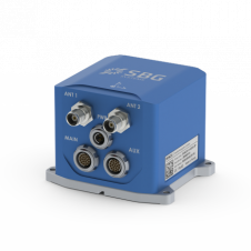
SBG Systems has released a new version of the Ellipse Series, its product line of miniature inertial sensors. The Ellipse has been improved, showing increased performance in attitude and heave...

SBG Systems has released a new version of the Ellipse Series, its product line of miniature inertial sensors. The Ellipse has been improved, showing increased performance in attitude and heave...
SBG Systems is launching the Ekinox 2 Series of compact inertial navigation systems. With new accelerometers and gyroscopes, Ekinox 2 attitude accuracy has been enhanced by a factor of two...
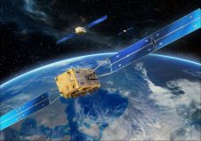
Trimble’s VRS Now networks can now process Galileo observation data in its network-modelled Virtual Reference Station (VRS) solution. As a true five-constellation technology using GPS, GLONASS, BeiDou, QZSS and now...
GNSS has now been operational in the surveying industry, and especially in hydrography, for more than 25 years. Whereas the first receivers such as the Sercel NR103 (once the workhorse...
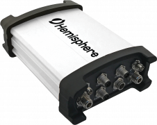
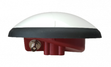
Hemisphere GNSS has introduced the all-new Vector V1000 GNSS receiver, which provides high-accuracy heading, position, pitch, roll and heave data. The V1000 supports multi-frequency GPS, GLONASS, BeiDou, Galileo, QZSS and...
Oceaneering has announced the release of the C-Nav5000 GNSS receiver, which uses 252 tracking channels capable of tracking phase and code of all available constellations, including GPS, GLONASS, Beidou and...
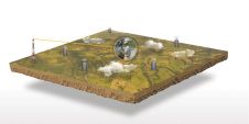
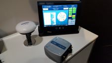
Hydrographic surveying is highly specific and requires a suite of advanced acquisition and positioning sensors attached to a mobile survey platform as well as sophisticated software to allow the correct...
Tallysman Wireless has announced two new advanced VeroStar marine antennas to add to its industry-leading line of GNSS products. The VSP6037L-MAR supports the full GNSS spectrum and the VSP6337L-MAR supports...

It is almost impossible these days to imagine geoinformation without GNSS, and most geodetic services have switched to GNSS to maintain their geodetic reference network rather than using traditional optical...
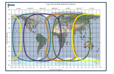
Fugro Marinestar measures GNSS satellite orbit and clock corrections for GPS, GLONASS, Galileo and BeiDou. These corrections are sent over six geostationary L-band satellites and over internet and can be...
This site uses cookies. By continuing to use this website, you agree to our Cookies Policy. Agree