No More Spatial Misinterpretation Using Different Technologies
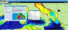
Malta, the smallest European Union state, has carried out a country-wide hydrographic survey which was initiated in Q1 2012 and completed in Q4 of the same year. Aimed at acquiring...
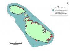
Malta, the smallest European Union state, has carried out a country-wide hydrographic survey which was initiated in Q1 2012 and completed in Q4 of the same year. Aimed at acquiring...
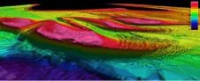
NaviModel 3.2, Eiva's DTM modelling package, has been released in a full 64 bit version. This release takes full advantage of all hardware, including parallel processing and additional memory. This...
The planned widening of the Dutch Maas river (Meuse) represents a landscape correction that will prevent future flooding. Gravel barriers are being prepared in order to buffer any additional flow....
Soundings and contours are the only official way data producers can push bathymetric information to the wide hydrographic community. The introduction of the S-102 standard for bathymetry will enable many...
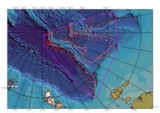
In 1997, the Russian Federation (RF) ratified the United Nations Convention on the Law of the Sea and started the explorations intended to specify the outer limit of the continental...
SeaZone can provide full UK coastal coverage of TruDepth Grids. SeaZone TruDepth Grids is a solution which delivers the best available information on water depth around the UK. The latest...
The European Commission has concluded service contracts for creating pilot components of the European Marine Observation and Data Network (EMODnet). The overall objective is to create pilots to migrate fragmented...
TruDepth Seamless Layer of UK Bathymetry TruDepth survey bathymetry products represent a collection of Digital Terrain Model (DTM) tiles. The models are based on the best available survey data from...
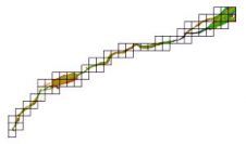
Swathe Services was recently commissioned by Falmouth Divers to assist on a 4km submarine power cable installation to a remote island community on behalf of one of their clients in...
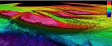
The development of deepwater and ultra-deepwater subsea fields is one of the greatest challenges facing the offshore oil and gas industry today. The depths involved present a host of engineering...
This site uses cookies. By continuing to use this website, you agree to our Cookies Policy. Agree