NOAA Nautical Chart PDFs Permanently Available at No Cost
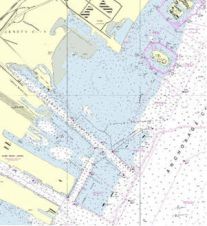
After a three-month trial period, PDF versions of USA’s NOAA nautical charts will become a permanent product, at no cost to the public. The PDFs, which are digital images of...
After a three-month trial period, PDF versions of USA’s NOAA nautical charts will become a permanent product, at no cost to the public. The PDFs, which are digital images of...

A major announcement was made this year by the International Maritime Organisation (IMO) who has set the schedule for mandating the use of electronic chart display and information system (ECDIS)....

The hydrographic survey within the Traffic Separation Scheme of the Straits of Malacca and Singapore will cover an area of 621.3 square kilometres around the One Fathom Bank area, representing...
The Panamanian flag state administration has authorised the use of electronic logbooks onboard all Panamanian flag vessels. The backing of the electronic logbooks by the largest shipping flag state in...
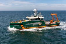
The N-Sea Group has formalized an agreement with Geo Plus for the long-term charter of the Dutch-flagged vessel the Geo Ranger, a cutting-edge hybrid survey and ROV support vessel. This...

When contemplating the replacement of a research and survey fleet, a collective effort is required to meticulously curate an optimal new fleet, considering factors such as ship type, size, capabilities...

How do you perceive prospects in the hydrographic surveying industry in 2024, compared to the past couple of years? When contemplating the hydrographic sector holistically, which areas of investment do...
S-101 is the new product specification for Electronic Navigational Chart (ENC) datasets based on the overarching S-100 framework standard of the International Hydrographic Organization (IHO). The development of S-101 is...
This site uses cookies. By continuing to use this website, you agree to our Cookies Policy. Agree