Preparing for sea-level rise thanks to hydrography
In many places around the world, data clearly shows a rise in sea level. In low-lying coastal areas, even small increases when coupled with high tides and storm surges can...
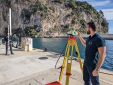
In many places around the world, data clearly shows a rise in sea level. In low-lying coastal areas, even small increases when coupled with high tides and storm surges can...
Seabed 2030 is rapidly approaching its ultimate objective of mapping the entire seabed within seven years. To achieve this goal, the project is actively seeking donations of both public and...
Much remains unknown about the benthic ecosystem that the blue economy depends on, and improved benthic habitat mapping is key to the sustainable development of the blue economy. While remote...
The topic of surveillance of civil offshore infrastructure is becoming an increasingly significant issue in Europe. For this reason, it is important to know that the operational civil ocean radar systems...
Surprisingly little is known about the underwater surface of our planet. In fact, with the Seabed 2030 project so far not even at 25%, the surfaces of Mars and Venus are better mapped than the Earth’s seafloor. At Hydro International, we're dedicated to staying ahead of the curve in the ever-changing world of hydrography. That's why we're thrilled to unveil our new look, complete with an updated...
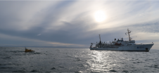
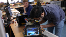
The state of the art in autonomous surface vehicles has evolved tremendously, and these technologies will revolutionize the field of hydrography. However, our experience shows that developing these systems to...
As sea levels continue to rise and storms intensify, countries such as the Netherlands – where a third of land is below sea level – are becoming increasingly concerned about...
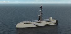
SEA-KIT International has announced its first uncrewed surface vessel (USV) export sale to ThayerMahan, a leading provider of autonomous maritime solutions based in Connecticut, USA. The X-Class USV’s combination of...
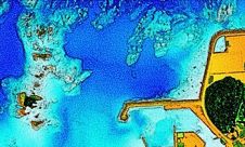
The ‘Umi-no-Chizu’ (‘Map of the Sea’) project will use aerial measurement to map 90% of Japan’s shallow coastal waters (to a depth of 20m). This is a joint project by...
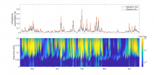
Measuring suspended particulate matter in the water column is still a big challenge when it comes to covering large areas in the sea or rivers. A novel method to monitor particles...
This site uses cookies. By continuing to use this website, you agree to our Cookies Policy. Agree