GEOxyz Presents New Hybrid Survey Vessel
The acquisition of the offshore survey vessel Geo Ocean VI marks the next step in the expansion of the offshore survey capacities of GEOxyz, the Belgium-based geodata specialist. With a...
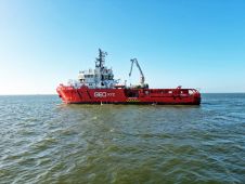
The acquisition of the offshore survey vessel Geo Ocean VI marks the next step in the expansion of the offshore survey capacities of GEOxyz, the Belgium-based geodata specialist. With a...
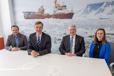
The UK Hydrographic Office (UKHO) has signed a memorandum of understanding (MOU) with The Nippon Foundation-GEBCO Seabed 2030 Project, which will see the parties work together to advance the industry’s...

Francisco J. Gutierrez is product specialist for the GeoSwath 4, Pulsar and TOPAS systems manufactured by GeoAcoustics Ltd. He previously worked as technologist for the Spanish Research Council and as...

Danny Websdale is an AI/ML research scientist at GeoAcoustics. He received a BEng degree in computer systems engineering (2014) and a PhD in audio-visual speech processing (2019), both from the...
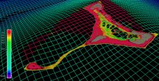
Artificial intelligence (AI) first came to light in the 1950s, when the ability of a machine to undertake an operation and adapt to changing conditions without human input was skirting...
In this edition of our Q&A series with leading experts from the hydrographic industry, Paul Seaton of Fugro shares his thoughts on a variety of topics, such as key market...
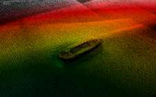
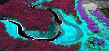
Satellite technology has been used to chart shallow areas of the Cook Islands’ seafloor in never-before-seen detail by scientists at the National Institute of Water and Atmospheric Research (NIWA) and...

As media partner, we are excited to share the brilliant news for the global ocean technology and hydrographic community that the Oceanology International (Oi) exhibition and conference is back on...

This week, Patrick Reyntjens, founder of GEOxyz, shares his thoughts on a variety of topics, such as key market trends, technology drivers and challenges, and the impacts of COVID-19 and...

The UK Hydrographic Office (UKHO) has strengthened its long-standing relationship with Open Geospatial Consortium (OGC) by enhancing its membership level from technical to strategic to provide greater leadership, boost innovation...
This site uses cookies. By continuing to use this website, you agree to our Cookies Policy. Agree