Forecasts for 2021: a Mixed Bag
Ready to invest, in equipment, staff and training, but unsure about future growth at this stage of the Covid-19 pandemic: that seems to be the outcome of our Hydro International...
Ready to invest, in equipment, staff and training, but unsure about future growth at this stage of the Covid-19 pandemic: that seems to be the outcome of our Hydro International...
Hydrographic offices (HOs) today exist in a world of accelerating technological change that is influencing human behaviour and creating new needs for and ways of exploiting data to understand our...
In early July 2020, an OceanAlpha ME120 unmanned surface vessel (USV) joined the national potash mining project in Lop Nur in the Chinese province of Xinjiang to conduct routine bathymetric...
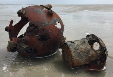
Munitions in the sea pose a risk to the sustainable development of the ocean economy. In particular, they are a global challenge during the construction of wind farms, pipelines and...
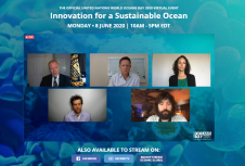
This week, the International Seabed Authority (ISA) marked the occasion of World Oceans Day on 8 June at the United Nations virtual event ‘Innovation for a Sustainable Ocean,’ where leading...

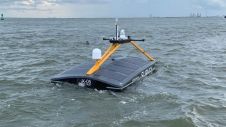
Inspection of dams is a high-risk task for divers because of strong currents and eddies. The use of emerging technologies such as uncrewed surface vehicles equipped with echosounders and sonars can...

Considered paradise by the legions of tourists who visit each year, the Caribbean islands are developing states that struggle to maintain a delicate balance between economic expansion and environmental preservation. Hydrographic mapping, a critical element in achieving this equilibrium, has been a service provided inconsistently by the developed nations upon which many of the islands are still dependent. Affordable new geospatial technologies, however, offer Caribbean islands the opportunity to reduce their traditional reliance and assume greater control over their economies and natural resources. Considered paradise by the legions of tourists who visit each year, the Caribbean islands are developing states that struggle to maintain a delicate balance between economic expansion and environmental preservation....
Every year, Geomares, the publisher of Hydro International, analyses the user data and behaviour of thousands of members of our global hydrographic and oceanographic communities. According to the latest findings...
Denmark has challenging seascapes to map and chart. It has a rich history of nautical charting that dates back to the seventeenth century, and many of its navigational products for...
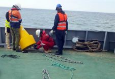
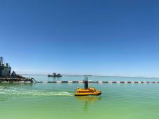
MSI, a company that provides meteorological and oceanographic (metocean) measurement services, was recently contracted to install a range of equipment for a period of between 2 and 4 months in...
This site uses cookies. By continuing to use this website, you agree to our Cookies Policy. Agree