UKHO and XOCEAN team up for uncrewed seabed survey
Marine data provider XOCEAN recently deployed five uncrewed surface vessels (USVs) near the Isles of Scilly to collect bathymetric data on behalf of the UK Hydrographic Office (UKHO). The USVs...
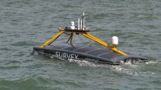
Marine data provider XOCEAN recently deployed five uncrewed surface vessels (USVs) near the Isles of Scilly to collect bathymetric data on behalf of the UK Hydrographic Office (UKHO). The USVs...

How do you perceive prospects in the hydrographic surveying industry in 2024, compared to the past couple of years? When contemplating the hydrographic sector holistically, which areas of investment do...
Over the past decade, the hydrographic survey community has benefited greatly from portable multibeam echosounders utilizing highly integrated electronics and powerful computational platforms. These sonar systems are smaller than their...
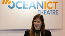
The co-located expo within Oceanology International 2024 has been expanded to bring together the most influential AI, communications, satellite, IT and IoT stakeholders. OceanICT, the only UK event focused on...
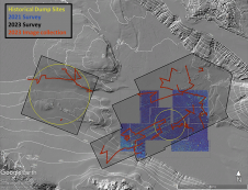
In a second seafloor survey off the Southern California coast, researchers from UC San Diego’s Scripps Institution of Oceanography uncovered a staggering 350 square kilometres of discarded military munitions. The April...

The development of unmanned and autonomous surface vehicles in recent years has triggered a new era in civilian and military maritime operations. One of the applications that is likely to...
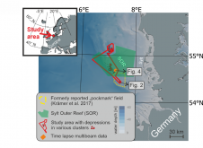
World oceans host diverse creatures that shape the seafloor. In a groundbreaking interdisciplinary study published in Communications Earth & Environment, Kiel University geoscientists, alongside biology and oceanography experts, have linked...
The CHA has a long-standing partnership with The Hydrographic Society of America, and the two organizations take turns hosting this annual international conference series. This year it is Canada’s turn,...
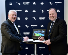
The global effort inspiring the complete mapping of the world’s ocean floor – The Nippon Foundation-GEBCO Seabed 2030 Project – has announced its newest partnership with Norbit Oceans, a leading...
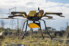
YellowScan, a familiar name in the mapping and land surveying realm, is making a noteworthy entrance in the hydrographic sector with the introduction of its pioneering UAV-based bathymetric Lidar solution....
This site uses cookies. By continuing to use this website, you agree to our Cookies Policy. Agree