Dave Neff
Dave Neff is an ACSM-certified hydrographer and geospatial programme director at Woolpert. Neff has managed hydrographic projects across the US and internationally, and has extensive experience in project management, vessel...

Dave Neff is an ACSM-certified hydrographer and geospatial programme director at Woolpert. Neff has managed hydrographic projects across the US and internationally, and has extensive experience in project management, vessel...
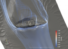
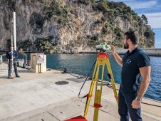
Shipwrecks are an integral part of our underwater landscape. According to UNESCO, there are three million wrecks worldwide, and these create various marine spatial planning challenges. To address these challenges,...
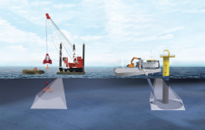
Germany’s Federal Maritime and Hydrographic Agency, the Bundesamt für Seeschifffahrt und Hydrographie (BSH), has awarded Fugro a geophysical survey contract for two offshore wind farm sites in the German exclusive...
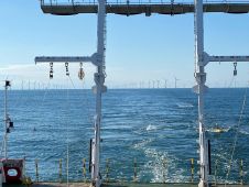
An estimated 95% of the oceans remains unexplored today, implying a huge market opportunity for innovative marine survey solutions. While the boom in offshore renewables projects will certainly continue, the...
Exail, a global leader in high-performance subsea inertial navigation systems (INS), recently launched the Rovins 9 DVL, an innovative all-in-one system that combines the strengths of inertial navigation and Doppler...
In many places around the world, data clearly shows a rise in sea level. In low-lying coastal areas, even small increases when coupled with high tides and storm surges can...
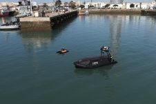
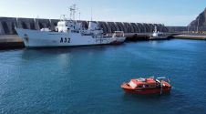
The hydrographic institute of the Spanish Navy, Instituto Hidrográfico de la Marina (IHM), has received three unmanned autonomous vehicles (USVs) from Norwegian company Maritime Robotics. Equipped with advanced sensor technology,...
The implementation of the new IHO hydrographic geospatial standard for marine data and information, the S-100 product family, presents significant challenges that require coordination between the IHO, the industry involved...
Marine energy, defence and science company Sonardyne has been selected to provide a subsurface communications and navigation network for the Smart Sound Connect Subsurface (SSCS) Project. Sonardyne will partner with...

Seabed 2030 is rapidly approaching its ultimate objective of mapping the entire seabed within seven years. To achieve this goal, the project is actively seeking donations of both public and...
This site uses cookies. By continuing to use this website, you agree to our Cookies Policy. Agree