New seabed maps uncover secrets below the surface
More than 1,500 individual seabed surveys have been combined to give sectors such as marine park management and offshore renewable industries – as well as storm surge modellers – a...
More than 1,500 individual seabed surveys have been combined to give sectors such as marine park management and offshore renewable industries – as well as storm surge modellers – a...
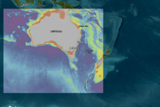
Experts are extremely concerned about the temperature of the Pacific Ocean, as the sea surface temperature this year was the warmest since satellite measurements began. This can have major consequences: for...
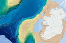
INFOMAR has presented the Blue Scale Map Series: a compilation of 18 meticulously crafted, high-resolution bathymetric maps showcasing the coastal waters of Ireland. Conceived and developed by a dedicated team...
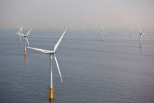
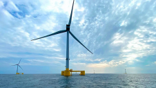
Energia Group and Vårgrønn have recently entered a partnership to co-develop offshore wind projects that align with the Irish Government’s goal of achieving a minimum of 5GW of new offshore...
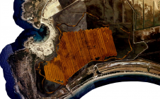
GEOxyz has been selected by TenneT, the national electricity transmission system operator of the Netherlands, to conduct geophysical and geotechnical surveys for the export cable route of the Nederwiek 3...
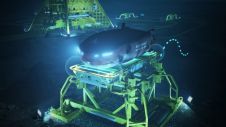
Nauticus Robotics, a developer of autonomous robots using artificial intelligence for data collection and intervention services for the ocean industries, has been awarded a contract with Petrobras, one of the...
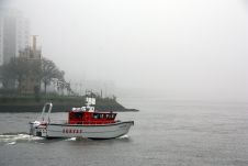
Unmanned surface vehicles (USVs) are increasingly being used for the mapping and management of shallow-water environments such as lagoons, rivers and estuaries, due to their economic and ecological benefits. The...
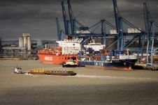
The UK Hydrographic Office (UKHO) has signed new Memorandums of Understanding (MoUs) with the Port of London Authority (PLA) and Peel Ports Group to enable greater collaboration in the port...
Celtic Sea surveys are scheduled to commence this summer as further details emerge regarding the proposed development of floating offshore wind. Specialized survey vessels are preparing to embark on a...
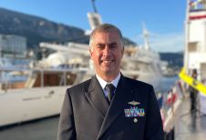
Hydro International interviewed RDML Benjamin Evans, director of NOAA’s Office of Coast Survey. Evans is responsible for overseeing the mapping and charting of all US coastal waters, as well as...
This site uses cookies. By continuing to use this website, you agree to our Cookies Policy. Agree