Will Blockchain Drop Anchor in Hydrography?
It is a long and fruitful tradition to consider emergent technologies as a driving force for progression in hydrographic appliances. The latest arrival on the scene is blockchain. While this technology...

It is a long and fruitful tradition to consider emergent technologies as a driving force for progression in hydrographic appliances. The latest arrival on the scene is blockchain. While this technology...
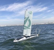
Ocean Aero, builder of environmentally powered, autonomous, unmanned, underwater and surface vehicles (AUUSVs), announced that it has secured multi-million-dollar strategic investments from both Lockheed Martin Ventures and Energy Innovation Capital...
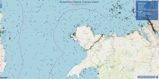
OceanWise has been awarded the framework agreement for the provision of GIS marine data to the Scottish government. The company will be delivering marine mapping data products and services including Marine...
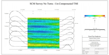
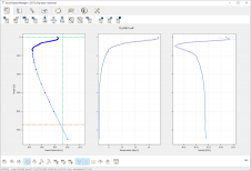
Teledyne Gavia, manufacturer of the Gavia autonomous underwater vehicle (AUV), has completed trials of the AUV self-compensating magnetometer (SCM) from Ocean Floor Geophysics (OFG). Following successful integration and field trials...
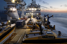
Ocean Infinity’s seabed mapping campaign commenced in the summer of 2017. The Ocean Infinity team is made up of individuals from multiple disciplines, who have gained vast experience with deep-sea...
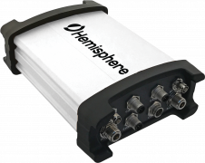
Hemisphere GNSS has introduced the all-new Vector V1000 GNSS receiver, which provides high-accuracy heading, position, pitch, roll and heave data. The V1000 supports multi-frequency GPS, GLONASS, BeiDou, Galileo, QZSS and...
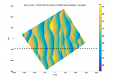
Optimizing the national hydrographic survey planning and monitoring scheme of the Netherlands Continental Shelf (NCS) towards an efficient and sustainable outcome requires a more comprehensive evidence-based approach to decision-making. The...
East View Geospatial (EVG) has reached an agreement with the French Naval Hydrographic and Oceanographic Service (Service Hydrographique et Océanographique De La Marine, SHOM) to offer digital nautical charts of...
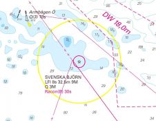
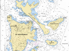
Sweden is a unique archipelago with thousands of islands, and hydrographic survey data is critical to managing its rocky coastal waterways. The Swedish Maritime Administration (SMA) is responsible for the...
Current technologies can help ocean mappers and cartographers to fight repetitive, manual and error-prone routines the smart way. In a world where artificial intelligence is playing a key role in...
This site uses cookies. By continuing to use this website, you agree to our Cookies Policy. Agree