Julià Talaya
Julià Talaya holds a PhD in Applied Mathematics. He has worked for ICGC for 32 years in various management roles, including GNSS positioning, aerial surveys, remote sensing and cartography. He...

Julià Talaya holds a PhD in Applied Mathematics. He has worked for ICGC for 32 years in various management roles, including GNSS positioning, aerial surveys, remote sensing and cartography. He...
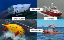
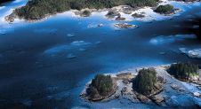
The life of a hydrographic planner used to be easy: you had a survey vessel from which (at least in nautical cartography) you deployed a number of survey boats (often...
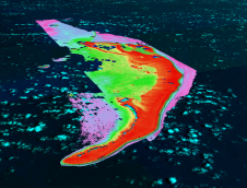
Much remains unknown about the benthic ecosystem that the blue economy depends on, and improved benthic habitat mapping is key to the sustainable development of the blue economy. While remote...
TCarta Marine, a global provider of hydrospatial products and services, is expanding its involvement in the Seabed 2030 project. The initiative aims to map the entire ocean floor by 2030,...
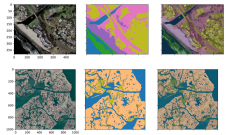
A new paper published in 'Scientific Data' presents the ‘CoastTrain’ dataset, a collection of orthomosaic and satellite images of coastal environments along with corresponding labels. The dataset includes 1.2 billion...
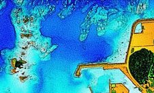
The National Oceanic and Atmospheric Administration (NOAA) contracted NV5 Geospatial to define the shoreline in an extremely complex area of south-east Alaska as part of the NGS Coastal Mapping Program....
The ‘Umi-no-Chizu’ (‘Map of the Sea’) project will use aerial measurement to map 90% of Japan’s shallow coastal waters (to a depth of 20m). This is a joint project by...

R-evolution has been awarded a contract to supply multidimensional intelligent mapping services of The Bahamas’ seabed. The services are part of a larger initiative to enable the island nation to...
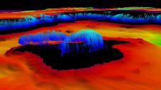
Hydrographers are increasingly aware of the added value that a Lidar (Light Detection and Ranging) scanner can bring to bathymetry survey operations. The Teledyne Optech Polaris Laser Scanner, for example,...
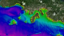
Since the 1970s, remote sensing has increasingly been used to conduct underwater surveys. Several methodologies are employed in hydrographic surveying, from direct techniques such as probing rods to more sophisticated...
This site uses cookies. By continuing to use this website, you agree to our Cookies Policy. Agree