Multibeam sonar reveals ship that warned Titanic of icebergs
The ship that sent an iceberg warning to the RMS Titanic before the ocean liner sank has been identified in the Irish Sea. Using state-of-the art multibeam sonar, researchers at Bangor...
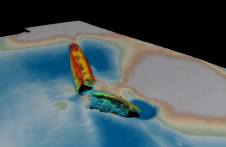
The ship that sent an iceberg warning to the RMS Titanic before the ocean liner sank has been identified in the Irish Sea. Using state-of-the art multibeam sonar, researchers at Bangor...
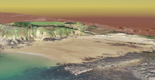
To understand coastal change and anticipate what our future coast will look like, scientists carry out regular field surveys in the form of beach profiles and digital elevation models (DEMs)....
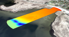
Morro Bay, a shallow coastal estuary located near San Luis Obispo, California, supports an abundance of wildlife and is home to a vibrant outdoor community. However, changes – such as sedimentation...

Capturing and measuring the environment in the Arctic and Antarctic is a particularly challenging job. The area of interest is often covered by a thick blanket of snow and ice,...
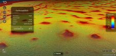
Uncrewed vehicles, both surface and airborne, are increasingly being used for hydrographic surveying. While the technology of data acquisition using these platforms is generally known, the fusion of this data...
TCarta Marine, the Colorado-based provider of hydrospatial products, will present its satellite-derived bathymetric (SDB) data sets on Terradepth’s Absolute Ocean visualization platform for the first time at GEOINT 2022. Additional...
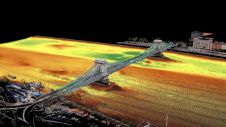
Two Hungarian companies designed a three-step data collection workflow to overcome the challenges in this urban surveying project in Hungary, which included the use of UAVs and remote-controlled boats for...
Marco Polo Marine, a reputable regional integrated marine logistics company, and F-drones, a Singapore-based company developing large-scale autonomous delivery drones, are pleased to announce the signing of a memorandum of...
Woolpert has acquired eTrac, a vessel-based hydrographic survey and marine technology firm that conducts custom and integrated marine services for projects across the U.S. and its territories. These marine services...
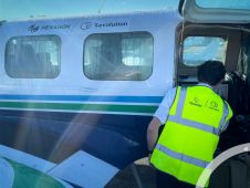
Hexagon, a global leader in digital reality solutions, today announced R-evolution’s efforts to map the threatened seagrass meadows of the Caribbean islands, beginning with the coastal waters of the Bahamas....
This site uses cookies. By continuing to use this website, you agree to our Cookies Policy. Agree