Hexagon Deploys Airborne Bathymetric Lidar to Protect Marine Environments
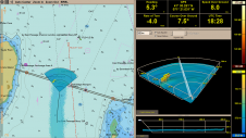
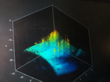
Hexagon, a global leader in digital reality solutions, today announced R-evolution’s efforts to map the threatened seagrass meadows of the Caribbean islands, beginning with the coastal waters of the Bahamas....