Lost 52 Project Discovers the Bow of WW II Submarine 'Grunion'
Tim Taylor and his team of the Lost 52 Project have identified the bow of the USS Grunion. It was discovered about a quarter of a mile from the main wreckage....
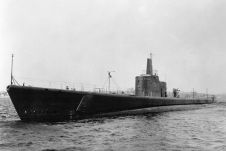
Tim Taylor and his team of the Lost 52 Project have identified the bow of the USS Grunion. It was discovered about a quarter of a mile from the main wreckage....
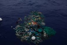
Ocean Voyages Institute, a non-profit organization, has successfully removed more than 40 tons of fishing nets and consumer plastics from the area known as the North Pacific Subtropical Convergence Zone,...
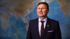
It's World Hydrography Day. This year's theme, 'Hydrographic information driving marine knowledge' helps us remember that hydrography touches our everyday lives. In this video, Dr Mathias Jonas, Secretary General of...

A study by the Woods Hole Oceanographic Institution (WHOI) clarifies what influence major currents in the North Atlantic have on sea level along the northeastern United States. The study, published June...

World Hydrography Day is celebrated each year on 21 June, which is also the beginning of the summer in the Northern Hemisphere. This year’s event signals the start of centenary...
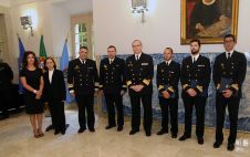
On 10 May 2019, the Hydrographic Institute held the diploma and badge award ceremony for the Specialization Course in Hydrography (edition 2017/2018). This course was completed by four officers of...
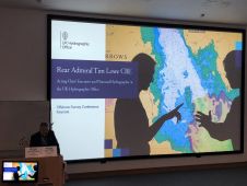
The decade of ocean science, starting in 2020 will make the future bright for the marine geospatial industry, said rear admiral Tim Lowe, acting Chief Executive of the United Kingdom...

Over 340 exhibitors from all over the world are offering the very latest technologies, water-based demonstrations, and learning and networking opportunities at the upcoming Ocean Business exhibition. More than 5,000...

According to a recent High Court Declaratory Judgment, those wanting to train as pilots in New Zealand must hold a master certificate or the equivalent. However, navy officers and pilots...
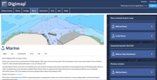
OceanWise’ intelligent marine mapping data is now accessible to students in Further and Higher Education across the British Isles via Digimap, the online map and data delivery service provided by...
This site uses cookies. By continuing to use this website, you agree to our Cookies Policy. Agree